Following the War of 1812, which ended in 1815 and in which both the U.S. and Canada repulsed the invading forces of the other, there remained concern in Canada of a potential invasion by U.S. forces. A particular worry was that the U.S. might gain control of the St. Lawrence River and block supply routes from Lake Ontario to Montreal at the confluence of the Ottawa River with the St. Lawrence.
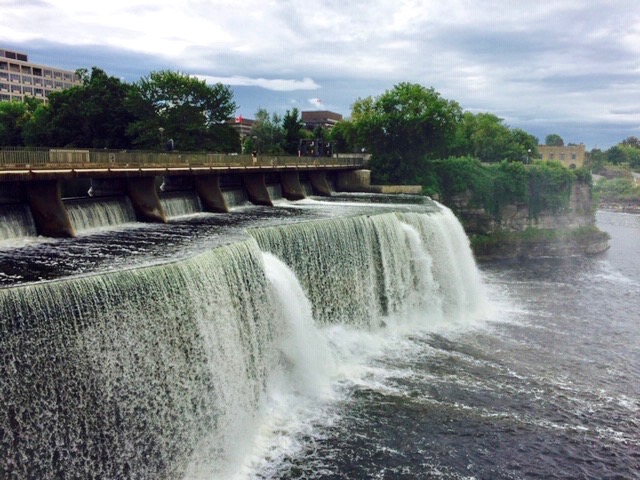
To alleviate lingering concerns, in 1826 England sent Lieutenant Colonel John By of the Royal Engineers to supervise construction of a canal linking the docks at Kingston, where Lake Ontario spills out as the St. Lawrence River, with the Ottawa River at the city of Ottawa, thus providing an alternative shipping route to Montreal, which is downriver from Ottawa. The Rideau Canal opened in 1832, named for the Rideau River that the canal uses as it approaches Ottawa, which in turn apparently got its name from the twin waterfalls of the Rideau where it joins the Ottawa River. The French rideau translates to “curtain,” reflecting the appearance of the spilling water.
From Kingston, the route heads up the Cataraqui River system until at Kingston Mills a spread of locks begins, fourteen in all, that lifts boats onto the Frontenac Arch. Working its way through the lakes of the Arch, the canal reaches its highest elevation on Upper Rideau Lake near Newboro. Rideau Canal then descends through the Rideau Lakes and the Rideau River, this time with the aide of thirty-one locks, to pass through Ottawa and join the Ottawa River.
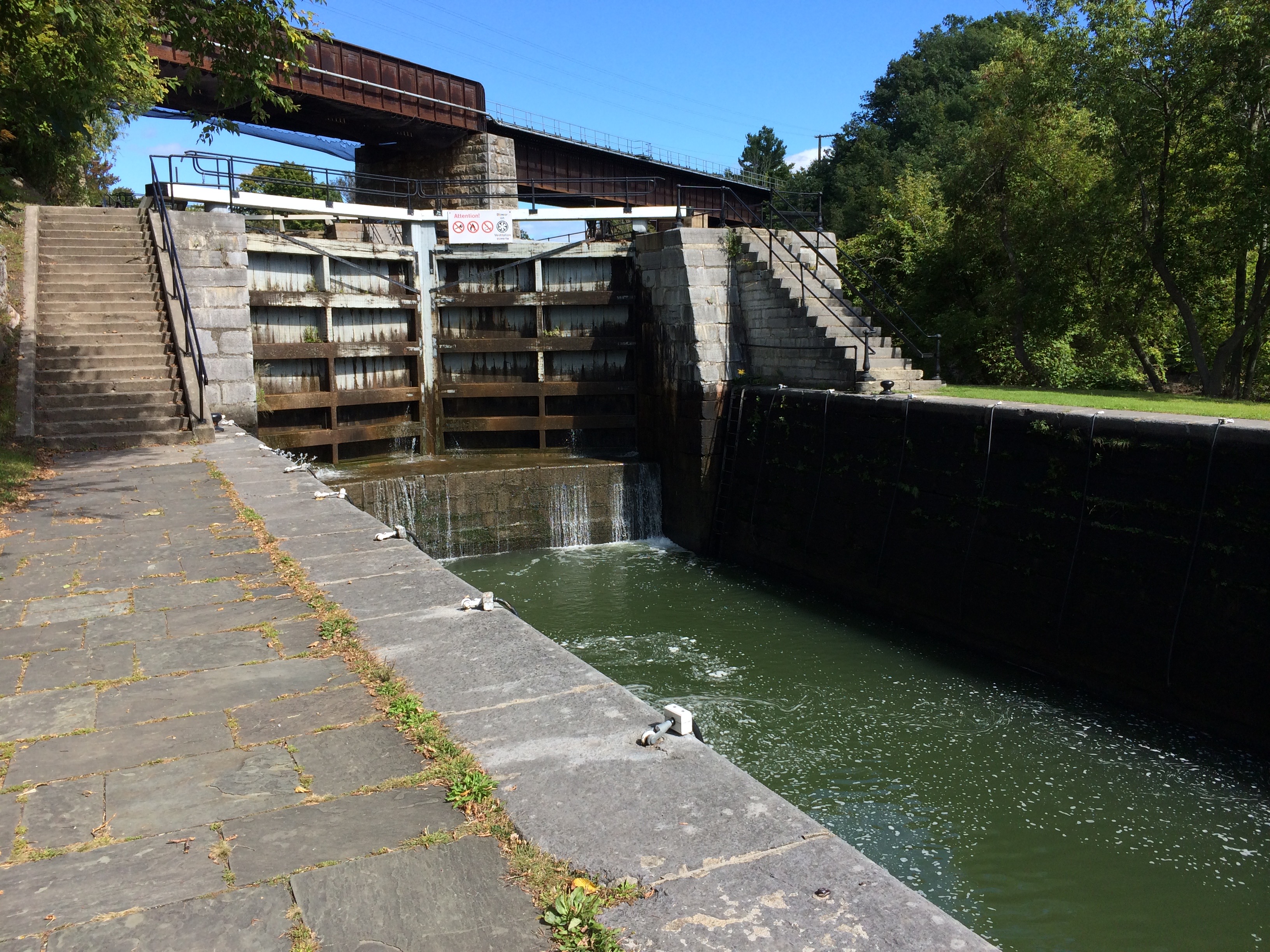
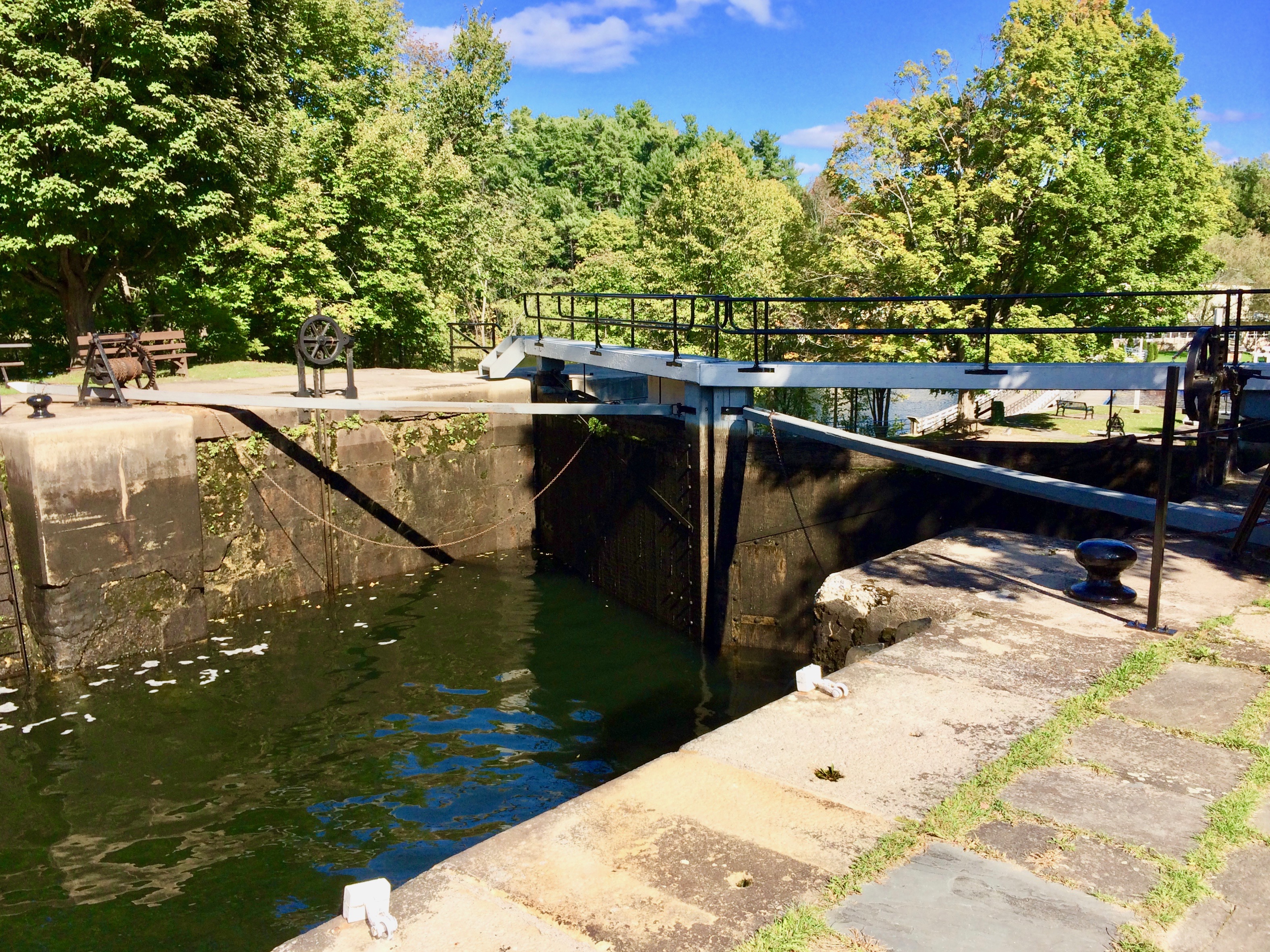
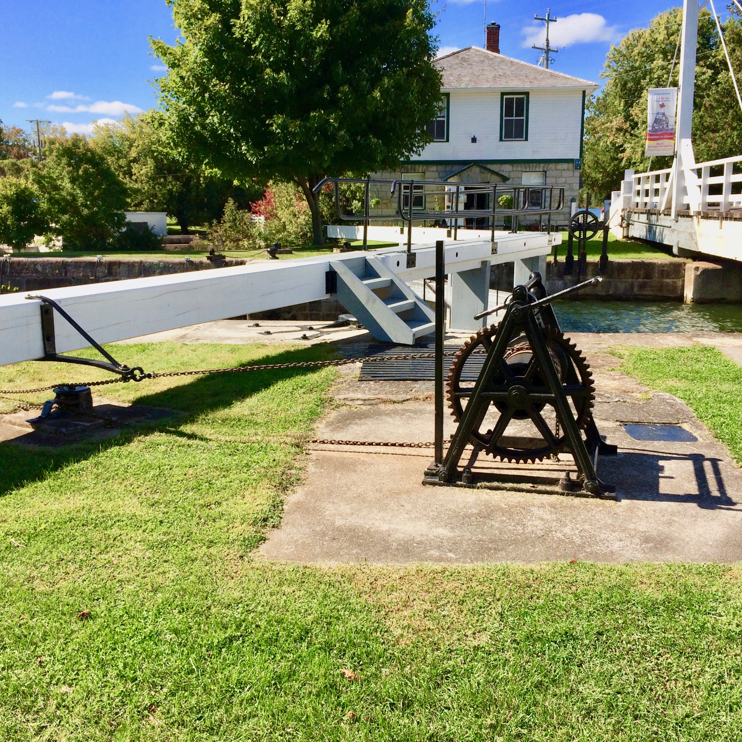
Intended as a military supply route in case of an invasion that never happened, the canal soon became a route for commercial shipping, especially in the early years when the canal was an easier shipping route than the St. Lawrence River. However, with the completion of the St. Lawrence canaland lock system and with railway construction, the Rideau lost its appeal as a shipping lane. In more recent times, Parks Canada maintains and operates the canal for recreational boating. Still with most of its original structures intact, including twenty-three lock stations, the canal offers a unique historical experience, with lockmasters continuing to operate the lock gates by hand cranks.
At Upper Brewers Lock, I talk with a couple from Ohio in a small boat as they glide into the lock from the upper level. They grab drop cables along the wall to hold the boat in place as the water is displaced. The couple says they come every year or two for a few days of boating on the Rideau Canal. Lockage and mooring permits required; camping permitted at most lock stations. We started chatting at eye level as lockmaster and assistant opened valves to drain the water and began cranking away on the hand winch, called a “crab,” that opened the lock gates. At this station, it’s a “push-bar crab system” in which a long bar attached to the top of the gates is pushed by the cranking to open and close them.
By the time the water reaches a level with the next waterway ahead, I’m looking ten feet down to maintain eye contact. Soon the couple is on their way, headed for Cranberry Lake, while the two men winch the gates closed in the boat’s wake.
As the canal approaches Ottawa, the canal and river diverge, with the river to the right following its original course to spill in curtains of water into the Ottawa. The double channels provide a wonderful setting for the city. Wife, Sondra, and I wandered through the parks, greenways, and gardens along the Rideau Canal on our exploration of the canal’s approach to Ottawa.