We’ve just arrived in Fort Benton, Montana, to see one of the few places virtually unchanged from when Meriwether Lewis and William Clark passed this way in 1805. Son, Jason, who arrives from Bozeman in his truck hauling a drift boat, and friends Tim and Elaine from Tennessee have joined Sondra and me for a five-day float through the Missouri Breaks.
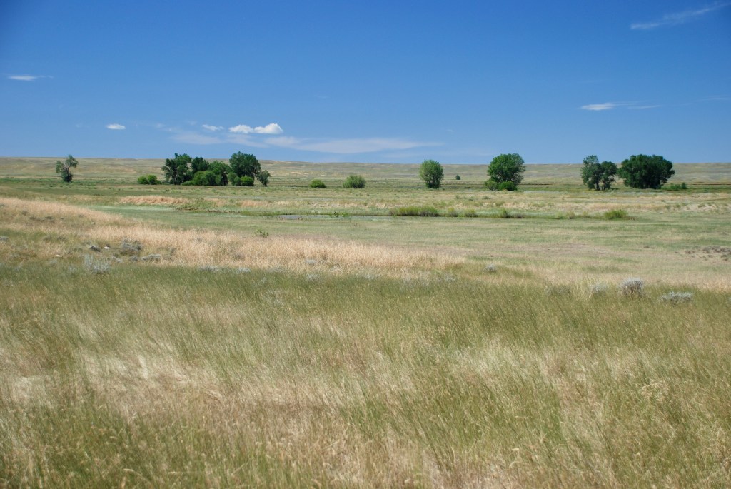
The Jefferson, Gallatin, and Madison rivers converge at Three Forks in Montana to form the Mnisose, the Missouri River. Reaching Fort Benton that lies quietly in the heart of Montana, the river bears east into a 149-mile section that’s the Upper Missouri National Wild and Scenic River, now incorporated in the Upper Missouri River Breaks National Monument. The national monument, along with the adjacent Charles M. Russell Wildlife Management Area, anchors a region of the Northern Great Plains that still has intact prairie sufficient to allow movement of plains wildlife, including bison reintroduced at the neighboring American Prairie.
I’ve made arrangements to stay at the Grand Union Hotel that has stood on the levee above the river since 1882. And grand it is, a three-story rust-colored brick structure that was the finest building in Montana Territory in its day and now on the National Register of Historic Places. When the Grand Union opened in November 1882, the town threw the biggest party the Territory had ever seen, with over 300 people attending.

After checking in the Grand Union, we stroll along the steamboat levee that parallels the river. At the far end of the park stands the Lewis and Clark State Memorial, a larger-than-life statue of Meriwether Lewis, William Clark, Sacagawea (the Shoshone woman accompanying the party with her interpreter husband Touissant Charbonneau, a French Canadian), and her baby son, John Baptiste, who was born on the expedition.

The statue in Fort Benton commemorates the several days the Corps of Discovery spent at the nearby confluence of the Marias River, trying to determine which branch was the Missouri that would continue to the west. With frustration and a bit of humor, Lewis recorded, “thus have our cogitating facilities been busily employed all day.” After exploring both streams, both Lewis and Clark became convinced the southern stream was the continuation of the Missouri. Though the men of the expedition still disagreed, “they said very cheerfully that they were ready to follow us any wher we thought proper to direct …”
Back at the Grand Union, Tim suggests we first stop by the barroom that still had the look of an old west saloon, rich woodwork, bottles of liquor resting against a shining mirror, drinks sitting before us. Lewis and Clark occasionally doled out rations of grog to reward the men on days when moving the boats upstream had been particularly difficult. Not yet having started our trip did not sway us from enjoying a libation as well.
After, we settle at a dining table in the hotel restaurant. The white tablecloth seems incongruous in Lewis and Clark country. Most of the time the Corps of Discovery lived off the land, the men eating several pounds of meat a day to keep up their energy—deer, elk, antelope, bear. Sacagawea would scavenge plants and roots to supplement their high protein diet. We’re served pork tenderloin, trout amandine, green salad, and julienne vegetables prepared by a New York chef; oh, and something chocolate for dessert.
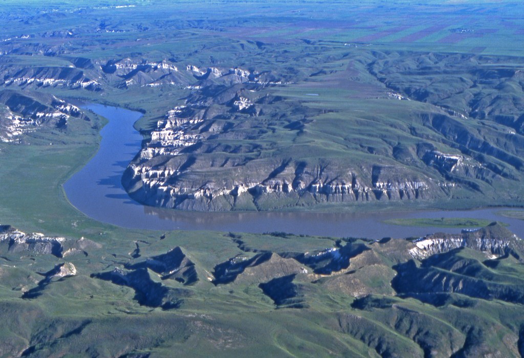
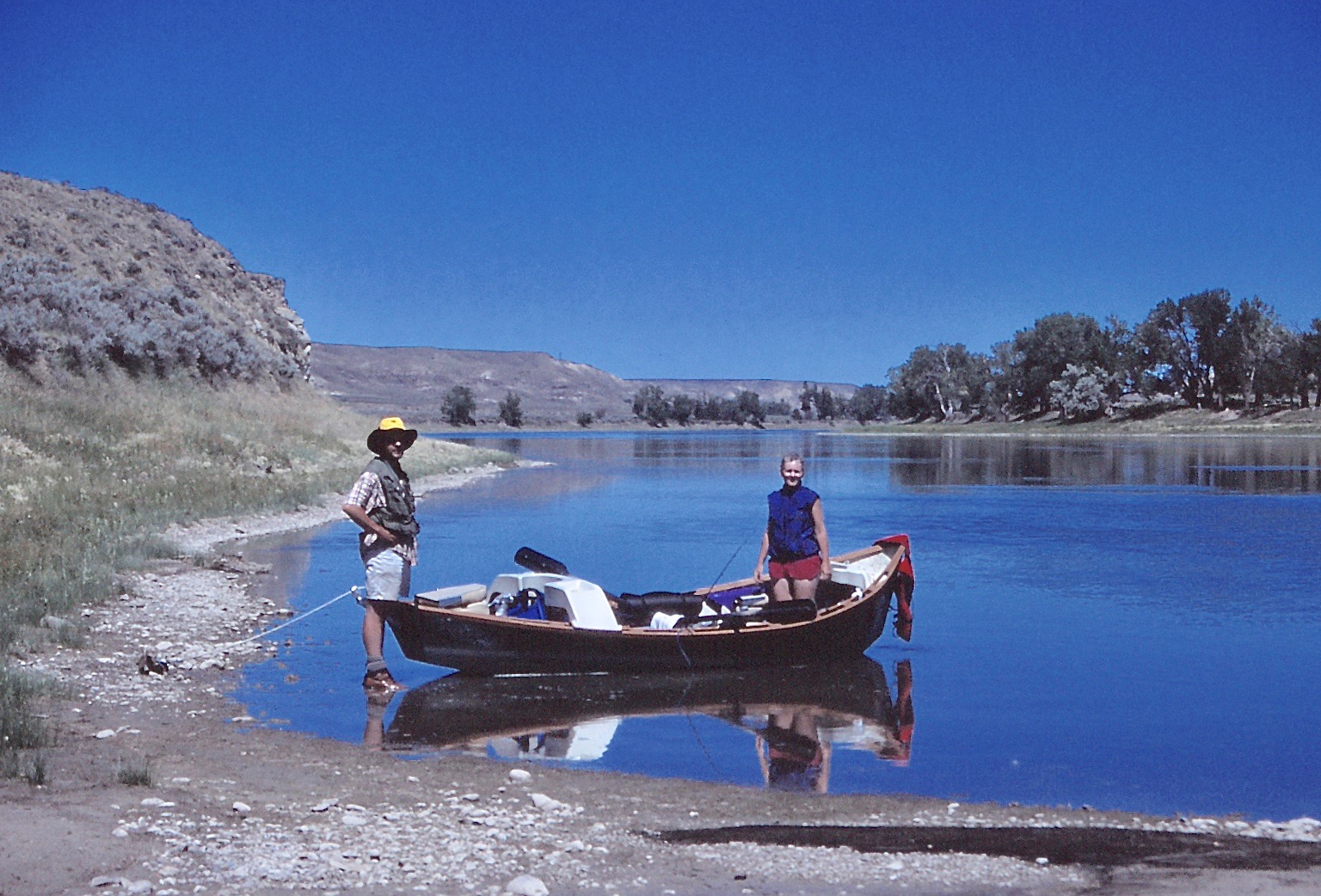
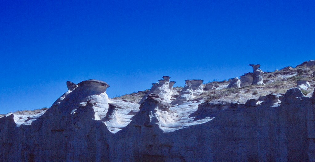
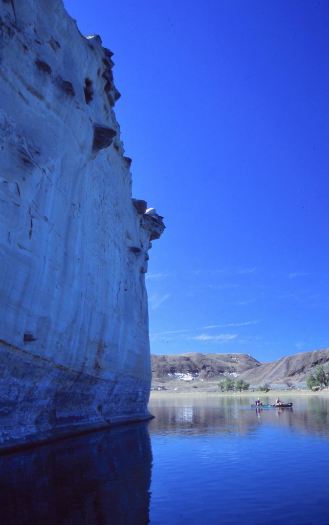
The next morning, we head for the river. We had decided to put in at Coal Banks Landing where there is a campground and boat launch. The 149 miles of Upper Missouri NWSR divides neatly into three geological segments. Stretching from Fort Benton to Coal Banks Landing, the “Upper River” meanders through a valley for 42 miles, passing the confluence of the northwest-bearing Marias River at about halfway along the segment. From Coal Banks Landing, the Missouri enters the “White Cliffs,” composed of the light-colored Eagle Sandstone laid down when an inland sea covered the area during the Cretaceous Period and left behind beach sands that became cemented together by calcite from sea shells. Beneath the near-white walls of rock, a darker formation of Marias River Shale crumbles and erodes to form slopes below the erect cliffs. Our trip will travel through the White Cliffs for 46 miles to Judith Landing. Beyond that landing, the river enters the “Missouri Breaks” where the river cuts into the central plain of Montana, leaving a broken landscape of canyons and rock formations.
(ID 7484583 © Jack Archibald | Dreamstime.com)
When Pres. Bill Clinton designated the 378,000-acre Upper Missouri River Breaks National Monument on January 17, 2001, protections were added that included restrictions on off-road vehicle use and bans on mining and oil drilling. Through the intervening years, national monument status has protected this section of the Missouri, and “Missouri Breaks” has come to mean the entire region encompassing the national wild and scenic river.
At Coal Banks Landing, a canoe has been dropped off for Tim and Elaine that we had arranged with Adventure Bound Canoe & Shuttle Company. Michael and Meredith Gregston, who operate the outfitting company, provided gear and recommended how much water to take. “You shouldn’t drink the river water,” Michael warned. “Runoff from the farms and ranchlands on either side make it unfit. So at a minimum, you’ll need a gallon of water per person per day.” Since the wild and scenic section of the river is quite remote, we have to cram in all our supplies, including the necessary 20 gallons of water. We left a key with the Gregstons, who will shuttle Jason’s truck to Judith Landing while we float the river.
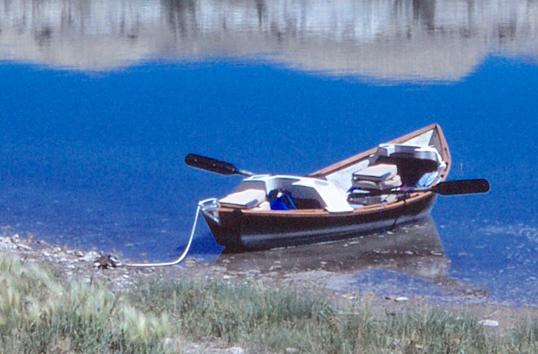
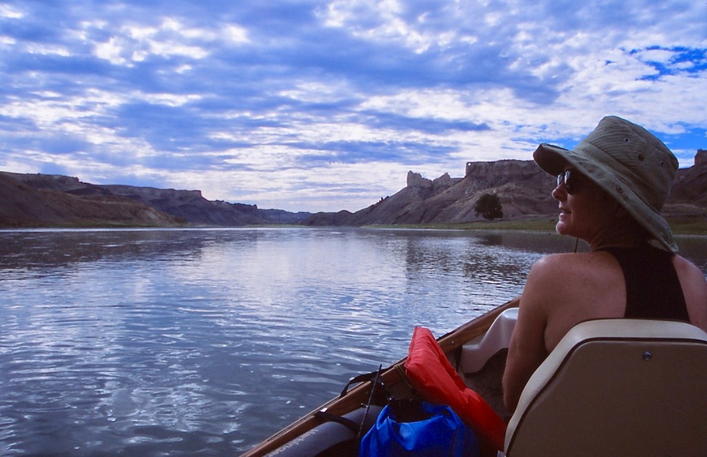
From the landing, Tim and Elaine paddle their canoe into the flowing river. Drift boats, however, curved at the bow and stern somewhat like a banana, are designed to float with the river current as the passengers sit back and watch the scenery, or fish, dropping a line into a passing hole and letting the boat troll the lure through the water. Jason’s boat is a fourteen-foot Yellowstone Drifter™, dark green and trimmed in ash. The oars are mainly for steering or crossing from one side of the river to the other. Jason stroked the boat into the river current, and we drifted.

The canoe, even fully packed with gear, moves much more quickly in the river than the drift boat. A couple of paddles and Tim and Elaine pull away downstream. But we keep them in sight as we follow the river. Here the walls hemming in the Missouri are not very high, just harbingers of what we will experience during the next few days.
Late afternoon, we pull up to the first established campsite. A fence surrounding the camp is meant to keep out the livestock, but a broken gap has let the cows in and patties are everywhere. So we move on downriver. A storm brews that blows at our backs and drops a little rain, but then passes quickly. Soon we pull right onto the starboard shore where a flat area would have made a good site for pitching the tents. But again, it’s a pastoral setting; cows have been everywhere.
Although the presence of cattle is an intrusion, having replaced much of the wildlife, I remind myself that Lewis and Clark probably had a similar experience. Lewis recounted that when he and Clark were at the confluence of the Marias River,
Capt. C. & myself stroled out to the top of the hights in the fork of these rivers from whence we had an extensive and most inchanting view; the country in every derection around us was one vast plain in which innumerable herds of Buffalow were seen attended by their shepperds the wolves; the solatary antelope which now had their young were distributed over it’s face; some herds of Elk were also seen…
Surely Lewis and Clark also stepped in a pile from time to time.
We cross to the port side of the river. Cows have been less frequent; we find only an occasional cow pie. So we set up tents, fold out camp chairs, and sit to watch the river lazily passing by.
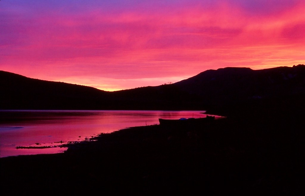
Later, Sondra and I cook up a pot of rice and lentils for the group over a white-gas stove. Afterwards, we settle once more into our camp chairs to await the day’s end. As the sun sets behind us, the river waters blush with a molten glow that spreads onto the far side bank.
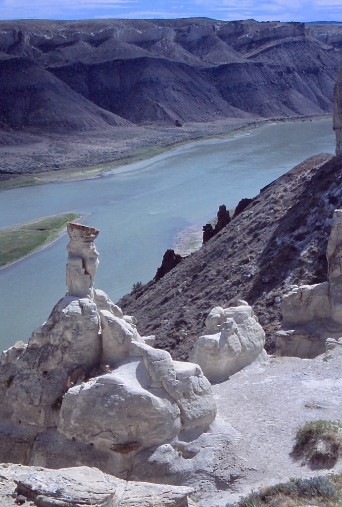
Next morning, Tim and Elaine prepare a hearty breakfast of eggs and bacon, and we head out. Just downriver on the left, we can see the Jappey ranch, settled around 1900 according to Glenn Monahan in Montana’s Wild & Scenic Upper Missouri River. In the yard of the ranch house stands a large igneous rock extruding from the level bench above the floodplain. Such formations, common along this stretch of the Missouri, resulted from upward intrusions of magma into cracks and fissures in the Eagle Sandstone millions of years ago. More resistant to erosion than even the sandstone, igneous intrusions are left standing as the sandstone erodes away. Easily seen from the river, “Pilot Rock,” as it came to be called, served as a landmark for pilots navigating steamboats upriver in the decades following Lewis and Clark.
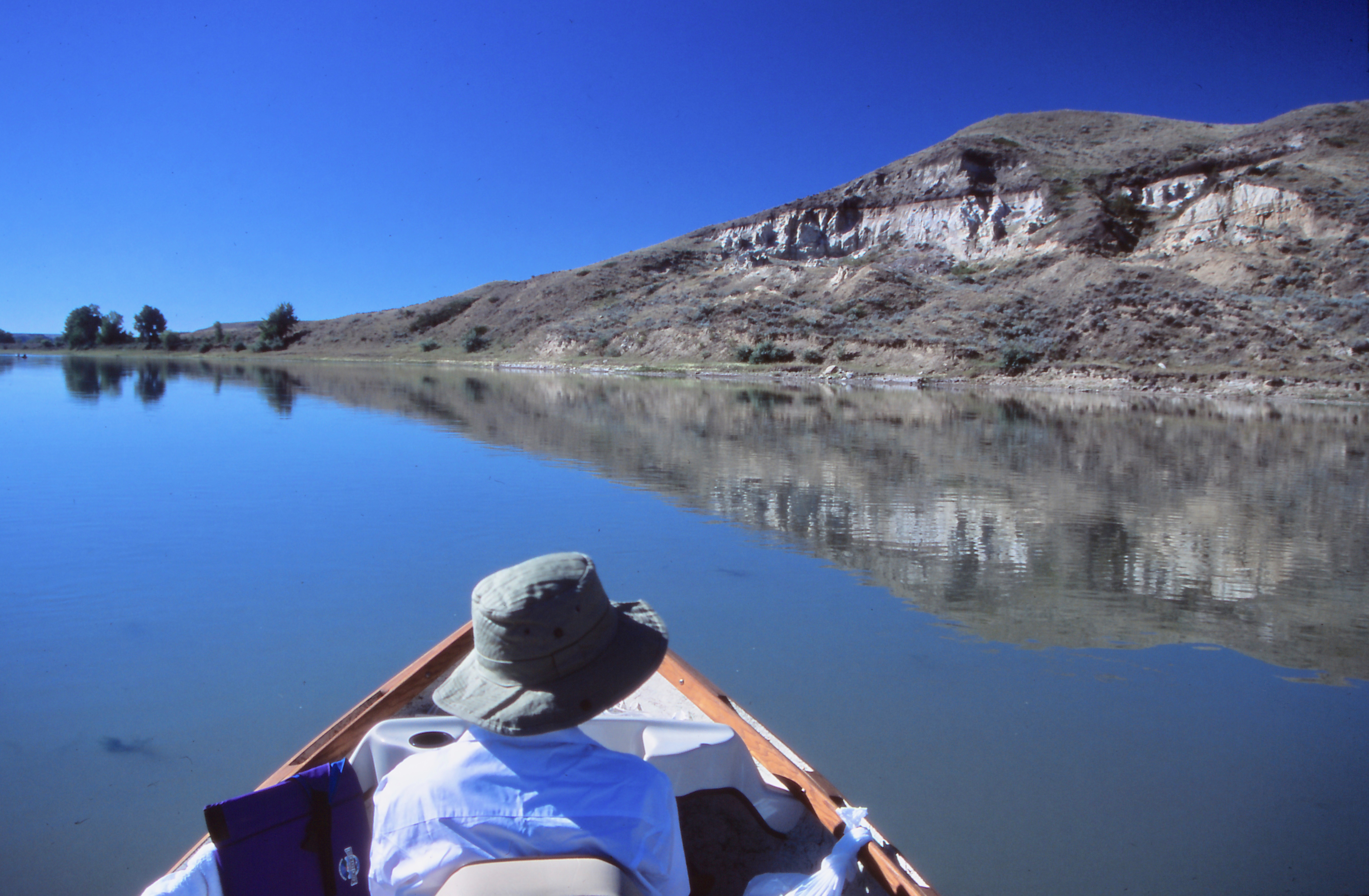
Beyond the ranch, we enter the White Cliffs where the Missouri has eroded into the Montana plain, creating a river gorge of massive cliffs, pillars of stone, rock formations of every shape and variety. When the Corps of Discovery passed through the gorge, the usually restrained Lewis was obviously thrilled,
The hills and river Clifts which we passed today exhibit a most romantic appearance. The bluffs of the river rise to the hight of from 2 to 300 feet and in most places nearly perpendicular; they are formed of remarkable white sandstone which is sufficiently soft to give way readily to the impression of water; two or thre thin horizontal stratas of white freestone, on which the rains or water make no impression, lie imbeded in these clifts of soft stone near the upper part of them. … The water in the course of time in decending from those hills and plains on either side of the river has trickled down the soft sand clifts and woarn it into a thousand grotesque figures, which with the help of a little immagination and an oblique view, at a distance are made to represent eligant ranges of lofty freestone buildings, having their parapets well stocked with statuary … As we passed on it seemed as if those seens of visionary inchantment would never have and end …
Stephen Ambrose, author of Undaunted Courage, Meriwether Lewis, Thomas Jefferson, and the Opening of the West, concurs. Speaking of the White Cliffs, he says, “It is today as Lewis saw it. …Of all the historic and/or scenic sights we have visited in the world, this is number one. We have made the trip ten times.”
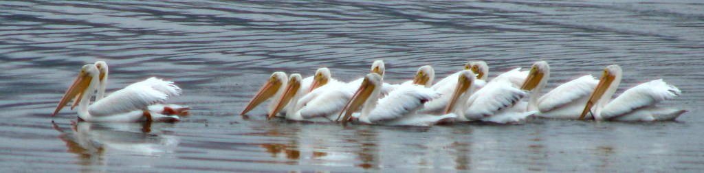
We see white pelicans (Pelecanus erythrorhynchos) gliding over the water, standing on the tips of rocks protruding from the water, or wading in the shallows.
(ID 86179699 © publicdomainstockphotos | Dreamstime.com)
I wonder if the Corps of Discovery thought the Pacific was just on the other side of the distant Rocky Mountains since they were already encountering coastal species of birds. Seagulls (Larus) winging by overhead seem as out of place as the pelicans.
We spy the remains of a stone cabin and pull our two-boat flotilla to the starboard shore. Disembarking, we walk a sagebrush-lined path up to half walls standing bleached in the sun, the first of frequent abandoned homesteading sites we will see along the river.
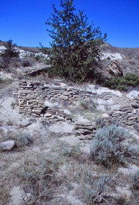
Jack Munro built this particular stone cabin prior to 1900. A stonemason, Munro built several houses along this stretch of the Missouri. Primarily, he raised horses that he let run loose in the Breaks and so was also known as a “rustler”—not a horse thief, but as in he “rustled up” the horses when time to sell them in Miles City that lies southeast of the Breaks.
The Homestead Act of 1862, intended to disperse public lands into private hands, allowed a homesteader to claim 160 acres, which he had to improve with house, fencing, crops—a process called “proving up”—within five years.
Later the acreage was increased to 320 acres and the proving-up time was reduced to three years. The Stock Raising Homestead Act of 1916 permitted 640-acre tracts for raising livestock, which was a bit more successful than farming.
However, homesteading was never successful on the Northern Great Plains, especially in the Breaks. Drought, isolation, and rocky soil combined to drive most homesteaders from their lands, leaving behind their improvements that deteriorate and crumble over time.
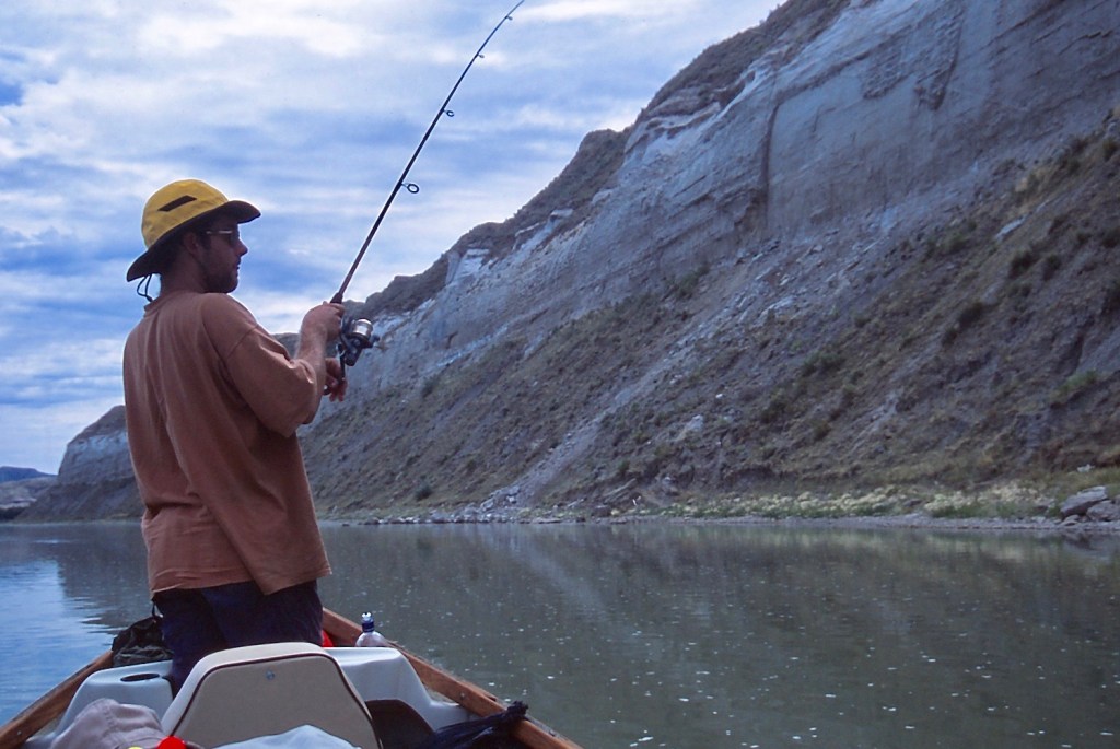
It’s a hot afternoon back on the river. Cliff swallows (Petrochelidon pyrrhonota) flit in and out of their mud nests stuck to the canyon wall in condos. Jason steers the drift boat to the port side of the river where we glide against a sheer rock wall and drop anchor in the shade, the canoe coming alongside.
We throw fishing lines in the water while we cool off, seemingly sealed in the dark shadow by the bright sky and sun-drenched river outside. Jason, a resident of Ennis, has drifted and fished the upper part of the Missouri and the Yellowstone, Madison, and Jefferson Rivers. He’s been looking forward to fishing this downriver stretch of the Missouri. He catches the first fish, and quietly laughs as he says, “This river won’t skunk me.”
We reemerge into the sunshine and move on down to a grove of cottonwoods on the left where we have lunch. This was likely the campsite of the Corps of Discovery on the evening of May 31, 1805. Nearby, Eagle Creek joins the Missouri. Lewis records they camped at “the upper part of a timbered bottom on the Stard. side … just above the mouth of … a stone wall creek.” In the winter of 1910, the steamboat USS Mandan became locked in ice here, until the ice thawed enough to release the boat. The Mandan continued to travel the Missouri until 1921, becoming the last steamboat to visit Fort Benton.
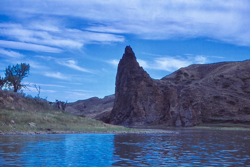
As we sit in the shade of the cottonwood trees, I see just across the river a jutting igneous pillar that is LaBarge Rock, which served as another landmark during the years of steamboats plying the river. I point out the rock. There were in fact two LaBarge brothers, John and Joseph, who captained Missouri River steamboats. Joseph LaBarge, pilot as well as captain, was known as one of the most skilled pilots on the river; however, it was John who piloted the Chippewa, the first steamboat to reach Fort Benton in 1860.

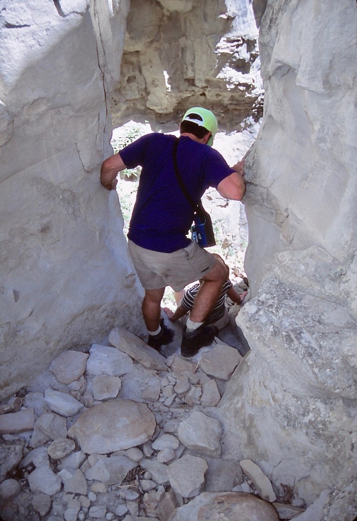
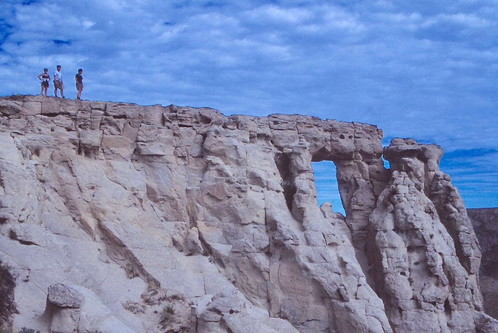
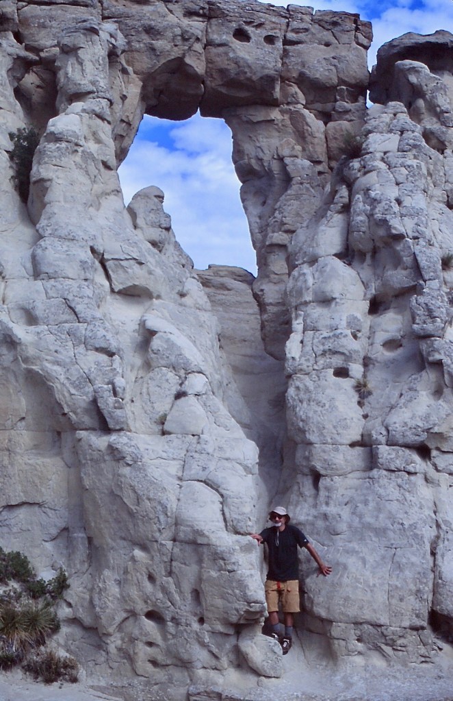
As the rest of the group settles in for an afternoon nap beneath the cottonwoods, I tell them about the Eye of the Needle. “Somewhere high on the rocky cliff near LaBarge is a rock formation called the Eye of the Needle, and I think I see a path on the other side of the river that probably leads up to the formation.”
The original rock formed a natural window at the top of the rock cliff; but the top span has now fallen. I want to see what is left of the iconic formation.
“If no one else wants to brave the midday heat … ,” I say, daring someone else to go along.
“We’ll go,” Elaine says.
“Do you want to swim across?” Tim asks.
“Actually the river is shallow enough we can walk across. But if we take your canoe, then I can bring along my camera without the risk of stumbling and dunking it in the river.”
Sondra and Jason elect to snooze in the shade; so we three cross the river in the canoe and follow the shore to the path I saw from the other side. The trail soon penetrates a cut in the wall of the canyon. Tim asks “Which way?”
“The photos I’ve seen show it overlooking the river. So we’ll need to climb to the top here and circle around to the cliff edge.”
The path veers right to a steep crack in the cliff that we scramble up. I lead the way, bellying up a ledge. We then encounter a rock chute that has a couple of knobs we use as hand- and footholds. If it were raining, there would be no way up this slickrock. Our boots grip the dry sandstone well enough. We climb on up to the top and look across the canyon to where Jason and Sondra are ensconced in the cottonwood grove.
Tim, Elaine, and I walk to the right along the ridge and find the remains of the Eye of the Needle, now just two curved sandstone columns with the lintel missing. When the pieces of the top span were found at the bottom of the cliff below, they showed signs of being pried loose with a metal bar; so the conclusion was that vandals caused the destruction, although some insist it was the result of natural weathering of the rock structure.

I’m left dumbfounded in the face of such desecration. What is there to say anyway? I have heard there are similar Eyes of the Needle in the Missouri Breaks. With the myriad of rock formations we’ve seen, it would be remarkable if there were no others. I don’t know where they are, but given the fate of this one, I wouldn’t tell anyway.
We head down, reaching the slickrock chute where Elaine slides on her rear the last few feet. Then Tim with Elaine breaking his slide. I creep over the edge and down. Tim puts a foot up to stop my descent as I slide down. Then back to the ledge that we had bellied up. Elaine goes over with Tim holding on to an arm. Tim descends with help from Elaine below. I back over the ledge on my belly.
“How far down?”
Tim says, “A few inches.”
“OK, I’m letting go.” And just then Tim grabs my butt to help me down, while Elaine snaps a picture that I’ll not show here.
After reconnecting with Jason and Sondra, we soon pass Grand Natural Wall on the left, a thin wall of rock standing on end several hundred feet high, another igneous intrusion now exposed by erosion.
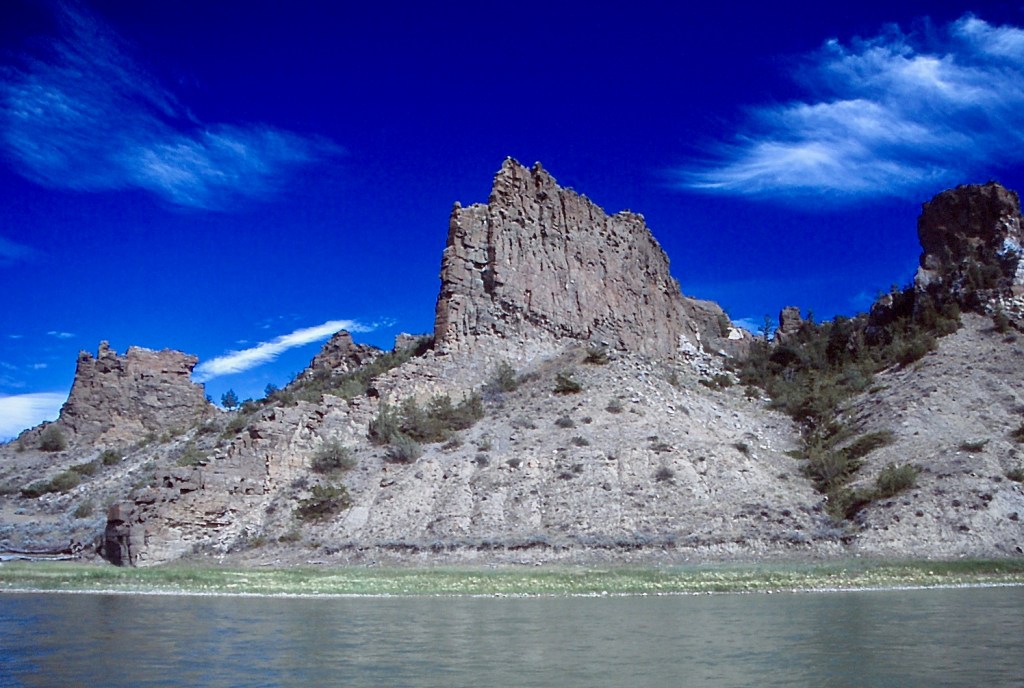
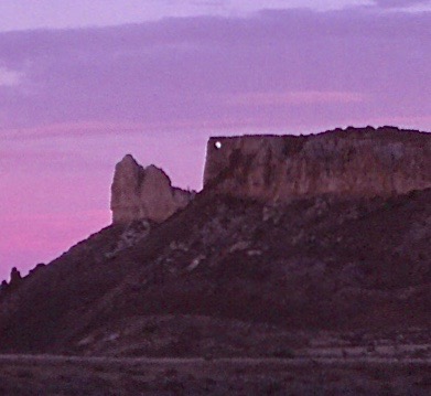
Farther downstream, Citadel Rock stands straight up out of the water a hundred feet or more. Clark described it as “a high steep black rock riseing from the waters edge.” Fur traders named the landmark, but another early explorer and his artist ensured the fame of Citadel Rock.
A naturalist and explorer, Prince Alexander Philipp Maximilian of the state of Neuwied, Prussia (now a part of Germany), set out to explore North America in 1832. Maximilian asked Swiss artist, Karl Bodmer, to accompany him. They traveled up the Missouri River on the steamboat Yellow Stone, making it as far as the Marias River before turning back. Upon returning to Europe, Maximilian turned his notes into Travels in the Interior of North America 1832 to 1834, accompanied by a selection of illustrations from the 400 watercolors Bodmer painted of Native Americans and the scenery they had witnessed. Bodmer also produced etched plates from his paintings and printed several editions of art that in time brought him more acclaim than the Prince had received. One of Bodmer’s more famous North American landscapes shows Citadel Rock. The rock itself had become such an obvious landmark along the river during the steamboat days that it was declared a state monument in 1967 and was added to the National Register of Historic Places in 1974.
As we ply the waters in the afternoon, temperatures soar. I drag my shirt in the flowing water and put it back on to cool off. The shock is painful, but the shirt soon warms against my hot skin in the broiling sun.
With the heat, Sondra goes overboard into the water to float along with the boat, wearing a shirt and floppy hat, now both wet and sagging, to protect her from the sun. She stretches out her arms and with cupped hands slowly oars herself along, her hands so small and vulnerable in the wide Missouri, it nearly breaks my heart.

Toward the end of the day, we glide into Hole in the Wall campsite, with a couple of log camping shelters and outhouses, the most developed campsite on the river. The camp shelters feel a bit homey but hot since the walls on three sides block any breeze. Jason decides to sleep in the open while the rest of us set up tents. Elaine and Tim cook a gourmet dinner that starts with smoked oysters from a can.
We can see in the distance downriver a literal hole in the wall, a window in the rock ridge that we will explore the next day.
ID 43052062 © Photowitch | Dreamstime.com
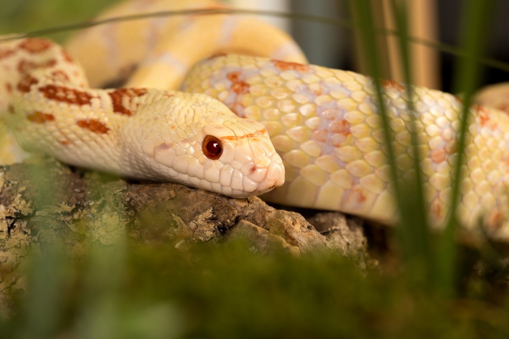
Wandering the campsite, I’m startled by a six-foot bullsnake (Pituophis catenifer sayi), a yellowish mottled constrictor that eats all manner of rodents. Although sometimes mistaken for a rattlesnake, the bullsnake is harmless and in fact helps to keep vermin in check around farms. I step away to call the others to come look, but in those few seconds, when I look back, the bullsnake is gone, having disappeared down some hole or under a bush.
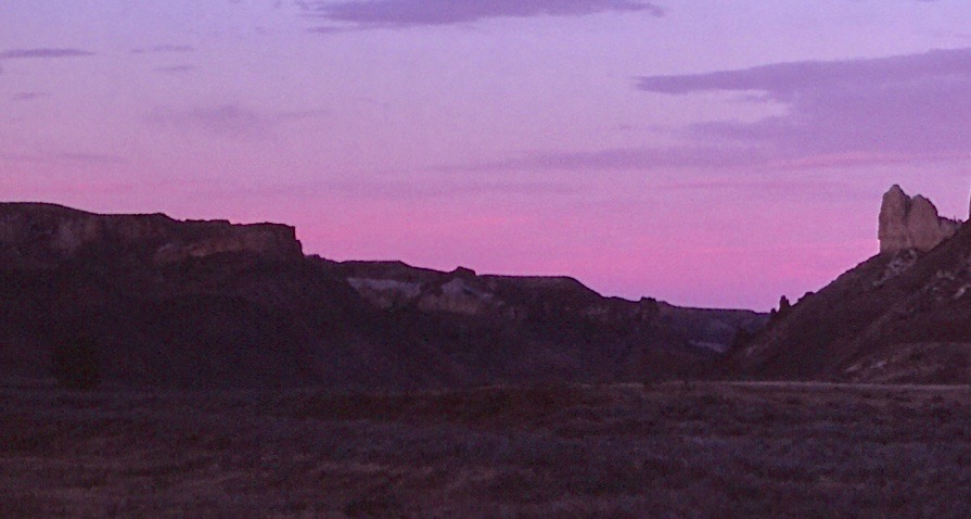
We thought there would not be much of a sunset this night because clouds hang low in the sky. But there is a gap of open sky above the distant ridge, and as the sun sinks below the horizon and shines on the underside of the cloud cover, a slight pink suffuses the silent air. The color then segues into orange that grows deep and fiery. The boats tied at the shore become black silhouettes backlit by the river bathed in red and gold.

Next morning, Sondra and I fix oatmeal with dried huckleberries for breakfast. It’s a bit overcast, so a cooler day to hike to Hole in the Wall. We pack up the boats and head downriver a little way to a faint trail that leads up toward the wall. Tim says he has seen photos of people in the hole.
“How can anyone get up there?” The hole seems to me to be suspended in a vertical wall with no way up. But we’ll find out.
I hike up the ridge, looking for a way, while the others hunt different locations for a route. On the ridge, I find a path and yell back down to the others. Single file, they follow the route I’ve taken. Once they join me, we walk a well-worn path that follows the ridgeline like the top of a winding wall. The trail leads up to vertical rock. But there the path turns and enters a crevice. We follow it, reaching a rock incline we must scale. On a ledge now, we walk up through rocks to emerge on top of the wall.
We walk a little way along the top of the wall, broad as a highway, and then drop off on the far side to get to the hole. We descend into a rock saddle that sweeps up to the hole. Jason ventures along the left side of the saddle to reach the chute leading up to the window where rock has fallen away from the narrow ridge, leaving the span of rock overhead forming a rectangular hole in the wall. A slide back down leads to the edge of a hundred-foot chasm.


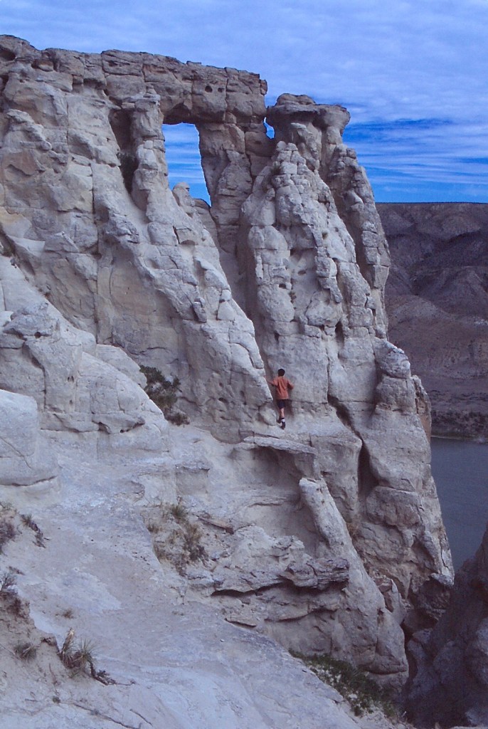


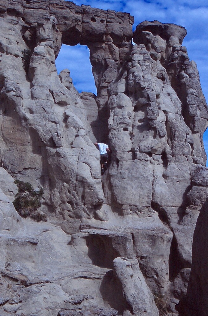

Elaine makes the climb and sits in the rock gap for photos. However, she struggles back down, reporting it’s a scary drop. Tim follows suit and on the way back down, unsure, holds up at the last few yards. Elaine talks him down. I skirt the hollow and reach the chute. Not as difficult as it looks, but I content myself with where I stand.
Back on top of the wall, I pause to look as the rest of the group descends the path. The broad ribbon of the Missouri winds away through the river canyon.
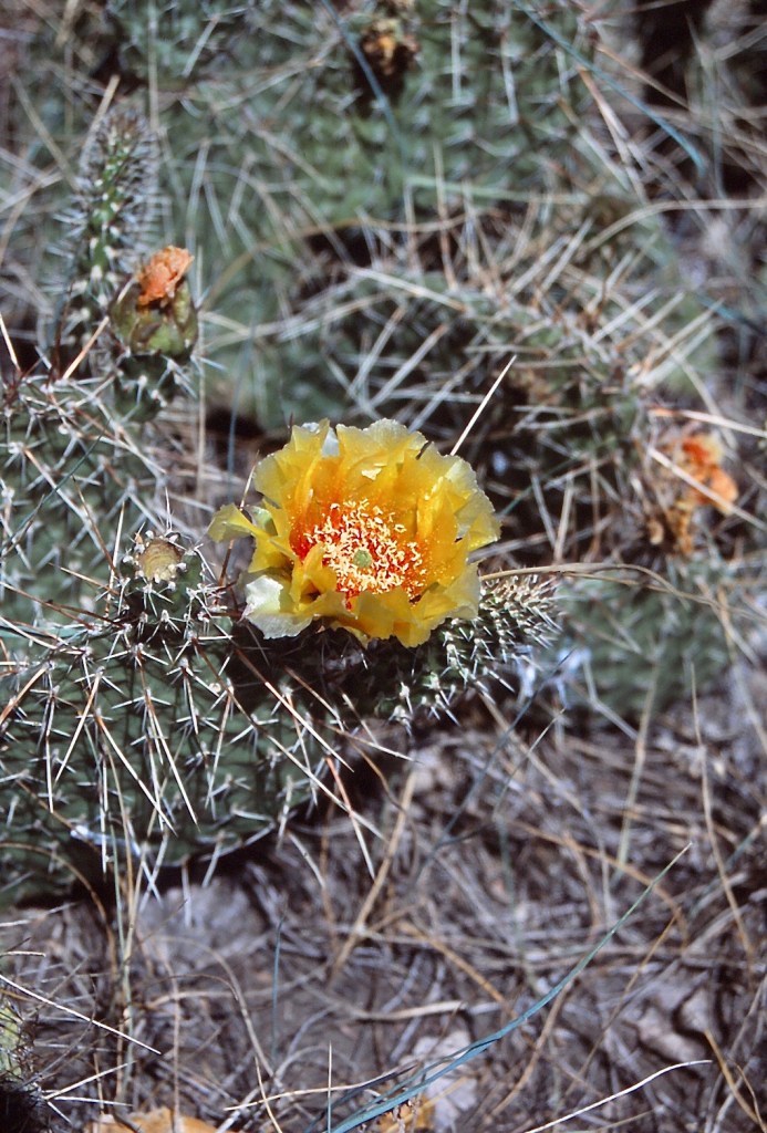
We continue downriver and stop for lunch at a campsite on the port side. I walk up to a river terrace behind the campsite dotted by yellow-blooming prickly pear cactus (Opuntia polyacantha).
In the distant hills sails Steamboat Rock, aptly named for the two rock pillars resembling smoke stacks that top the rock wall.

We pass more rock formations, dark extrusions, jagged white cliffs, hoodoos. Our group finds a place to spend the night on river starboard, a less-used campsite, only big enough for us; a few cow patties around, but not too bad. While Sondra and I fix pasta for dinner, the others hike up behind the camp. They climb a bluff and have a great view back down to the river, our campsite below in the trees.
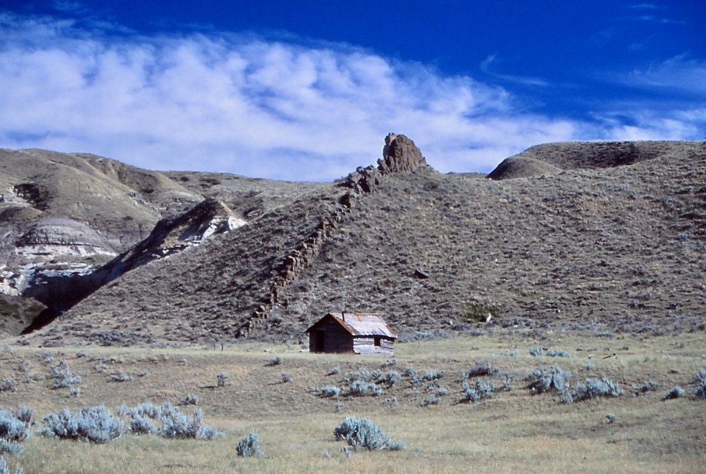
In the morning, we pass an old settler’s shack, another remnant of the homesteading period. Ferdinand Rolf settled here and filed a homestead entry in 1907; however, he failed to “prove-up” and the homestead was relinquished in 1913. The deteriorating shack gradually settles back into the land.
Jason lets the boat drift. Tossing in his fishing line, he catches a sauger (Sander canadensis)—protruding eyes, a prominent dorsal fin with thick spines and spotted with round blotches.
Tim also catches one and, being even less of a fisherman than I, asks, “What do I do now?” He and Elaine paddle over so Jason can take the fish off the hook and put it on his stringer secured to the boat; the two fish dawdle in the water beside the drifter.
Upriver from our location, Meriwether Lewis also caught some sauger, although at the time the fish was unknown to science. “This evening I ate very heartily and after pening the transactions of the day amused myself catching those white fish.”
The walls hemming in the river have noticeably reduced in size. This last full day on the river, we are floating out of the White Cliffs area into a less dramatic landscape.
We stop at a lesser-known campsite on the port side for our last night. A party of four women arrives a little later. One, a pretty young woman, slender, with long braided hair down her back, comes over. “We’re a guided trip. Mind if we camp here too? We’ll stay down at our end.”
“No, not at all,” I answer. “Enjoy your evening.”
“Thanks,” she calls back over her shoulder.
As we set up tents, I watch the party down at the other end of the cottonwood grove. The trippers relax as the two guides set up tents and bring out a stove to cook dinner after donning aprons. Bet there’s a tablecloth too.
On a low terrace behind the camp resides a prairie dog town. The little rodents pop out of their holes and stand on back legs to look around. A couple drop to all fours to bark at us. Prairie dogs (Cynomys ludovicianus) were once found throughout the Great Plains, perhaps as many as five billion, but loss of habitat and extermination have reduced the population by over 90% and have made them endangered.

Lewis and Clark encountered prairie dogs. Clark records “Capt Lewis & my Self …
…discovered a Village of Small animals that burrow in the grown (those animals are Called by the french Pitite Chien) …the Village of those animals Covs. about 4 acrs of Ground on a Gradual decent of a hill and Contains great numbers of holes on the top of which those little animals Set erect make a Whistleing noise and whin allarmed Slip into their hole.
In proximity to prairie dogs, Lewis noted, “a great number of wolves . . . ha[w]ks and some pole-cats were to be seen. I presume that those anamals feed on this squirril.”
We do not see any wolves or skunks, but we do find a falcon, attracted to the vicinity by the ready food source. Two fledglings sit with her in a bush. She stands guard on a branch nearer to the ground. We set up our spotting scope to watch.
The young guide comes over to see what we are about.
“Have a look,” Sondra says. “We think it’s a prairie falcon.”—Falco mexicanus. She holds out our laminated birding sheet and points to the image we think most closely resembles the bird.
The guide looks through the spotting scope and back to the birding guide. “Yep, I think you got it. Good work.”
Later, Jason cooks up an appetizer of the two sauger. Pan-seared in a little oil, the flesh is white and flaky. I guess being such a fine eating fish is at least part of the reason the limit is only one per person per day. Not having taken the trouble at the time to dig the regulation book out of the waterproof bag and confirm our identification, we had luckily stayed within our limit. Lewis didn’t have to worry about a limit, “I caught upwards of a douzen in a few minutes.”
In the evening we stretch out on the bank above the river and watch nighthawks (Chordeiles minor) skimming through the darkening sky, eating insects and emitting odd, deep-throated peent when they get near each other. Their long, angular, pointed wings allow these members of the nightjar family, not actually hawks, to dive and then pull up short when they make their sound, seemingly to warn each other off.
We stroll down to the water’s edge where we hope to catch another reflected sunset. The sun begins to paint the western sky, pale pink at first, and then brilliant reds and oranges. The boats tied up at the shore are once again black silhouettes against fire reflected from the water. Behind us, there must have been a shower in the distance; a rainbow streaks into the sky over the ridge on the far shore. Sunset and rainbow together.

The morning wakes to an overcast sky. Despite our rationing, we’re out of water, not even enough for coffee. So we load up and head downriver. Rain. It gets sloppy, and Jason and I take turns rowing against the wind, which would nearly hold us in place against the current if we just drifted. Still, a good morning—a golden eagle (Aquila chrysaetos) perches in a treetop at the water’s edge; mule deer on the shore lift their heads to watch us pass.
Near our takeout, we pass the mouth of the Judith River on the right. Along the Judith is where artist Charlie Russell stayed when he first came west with Jake Hoover. A hunter and prospector, Hoover taught Charlie western ways and is also credited with the discovery of sapphires in Yogo Creek, a tributary of the Judith, in 1895. The sapphires Hoover picked up were later found to have washed out of a dike, an intrusion of hardened magma, in Yogo Gulch. “Yogos,” as they came to be known, are the only sapphires in the world that do not need to be heat treated to achieve the blue color most prized for this gem. Yogos are mostly “cornflower” blue when dug out of the ground. In 1984, the Perry and Ridgeway families discovered another deposit separate from the dike in a nearby diatreme, a “pipe” of hardened magma, and formed a company to mine the sapphires, which proved to be some of the highest quality gems taken from the Gulch. Sondra and I met Marie Ridgeway in Lewistown after they had ended their operation. Marie was selling Yogos and nostalgically showed us photos of their mining days. I had to have one just to say I own a Yogo sapphire; the small one I chose sparkles a true cornflower blue.
In the drizzling rain on the Missouri, we pass under a bridge to our takeout on the left, the first sign of civilization we have seen since our put-in at Coal Banks Landing, other than a couple of homesteads. Lewis and Clark endured rain on this same stretch of the river. May 30, 1805, Clark recorded,
The rain commenced yesterday evining, and continued moderately through the course of the night, more rain has now fallin than we have experienced since the 15th of September last, the rain continued this morning, and the wind too high for us to proceed, untill about 11 oClock at which time we set out, and proceeded on with great labour …

Just beyond the bridge, Jason oars to the port shore at Judiths Landing, which like Coal Banks has a campground and boat ramp. Tim and Elaine in the canoe have reached land before us and, finding water at the campground spigot, have brewed coffee on a picnic table under the dripping trees. Elaine generously brings coffee down to us as we load the drift boat onto the trailer behind Jason’s truck. We turn the canoe over and leave it, as we have been instructed by the Gregstons, along with the oars, water containers, and life jackets underneath. We all load into the truck, Jason and Elaine in front and the rest of us in back.
It suddenly occurs to me—I have meticulously planned everything up to this point, including the shuttle that brought the truck from the put-in to the takeout at Judiths Landing, executed by the Gregstons. But no more.
“Hey, guys,” I call. “I have no idea where we are.”
————
Banner photo: Alberta Northern Plains by Sondra Jamieson
© Russ Manning. All Rights Reserved.
An ebook of much longer text and complete references for Northern Great Plains: The Missouri Breaks can be downloaded from amazon.com.

