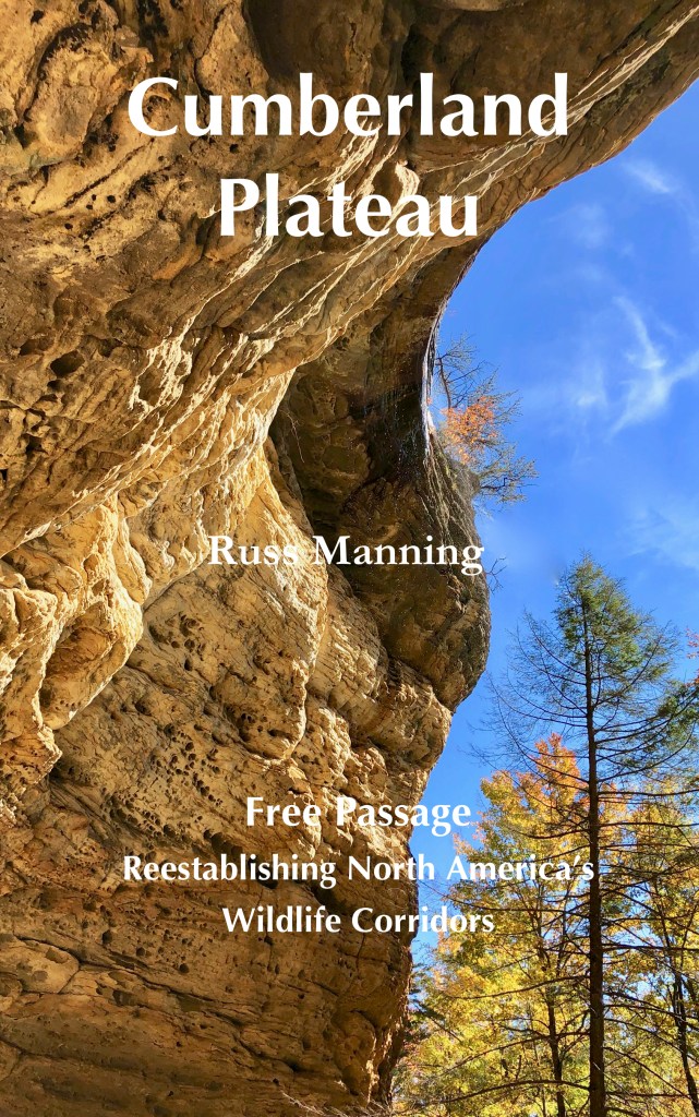
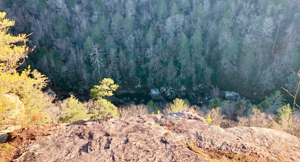
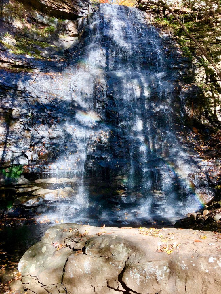
A rocky descent leads into the small gorge of Fall Creek on the Cumberland Plateau in Tennessee. From rock to rock, Sondra and I drop below the sandstone bluff as the trail we’re following leads to Ozone Falls, a narrow 110-foot column of water falling from the rock bluff into a blue-green pool. The waterfall and small community surrounding it take their name from the “stimulating quality of the air” that early residents claimed as they sought a retreat here at a higher elevation on the Plateau.
As much as I’ve explored the Cumberland Plateau, there are enclaves I have yet to see. So I’ve set a goal of exploring some of those unvisited preserves on the Plateau, following trails constructed by the states and also volunteers who see the necessity of connecting people with nature. One is this new 8-mile section of the Cumberland Trail from Ozone Falls west to Black Mountain. Crew Supervisor Shauna Wilson and her trail crew plus volunteers, all with the Cumberland Trails Conference (CTC), had just completed the trail section when I contacted Shauna for info on trail access. With her directions, she added, “Be safe out there. There’s some steep stuff on that segment.”
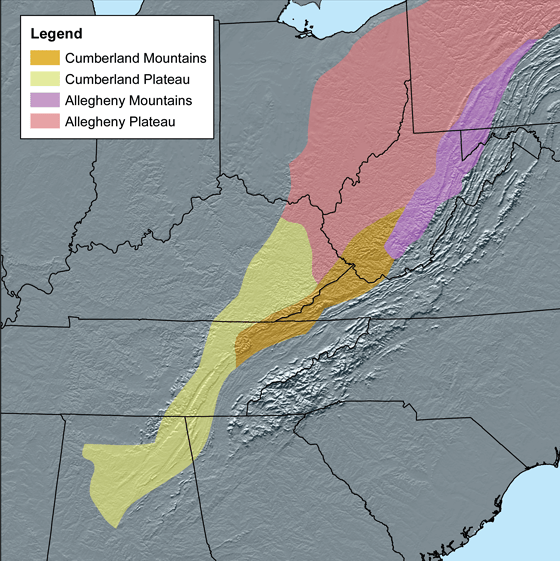
The Cumberland Plateau stretches southwest through the State of Tennessee into Alabama and the northwest corner of Georgia before eventually receding into the Gulf Coastal Plain. To the north, the Plateau passes through Kentucky and a slice of western Virginia. Beyond, the geologic structure continues into West Virginia and Pennsylvania, but there it’s called the “Allegheny” Plateau.
Approaching the Cumberland Plateau from the east, the imposing rampart rises a thousand feet above adjacent valleys. The plateau exists because of especially erosion-resistant sandstones that protect weaker rock layers beneath. Wherever a break in the sandstone cap occurs, erosion works downward into softer layers beneath rather than spreading laterally, resulting in the deep gorges, waterfalls, and sandstone arches.
These geologic features and the history of the region led to the designation of numerous preserves—a national historical park, more than twenty state parks, a national forest, a national river and recreation area, state natural areas, numerous state forests and recreation sites and wildlife management areas, two nationally designated wilderness areas, a national wild and scenic river, six state wild and scenic rivers, four national natural landmarks, a national monument, a national preserve, and a segment of a national military park.
The sheer number of the preserved areas establishes the Cumberland Plateau as a major wildlife corridor, if connections between these preserves can be maintained. A core area in the Eastern Wildway, the Plateau’s preserves and linkages enable white-tailed deer, black bear, reintroduced elk, bobcat, red fox, and hopefully future mountain lion to migrate north-south, along with all the lesser animals and plants that follow in their wake.

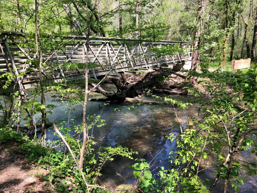
Already on “steep stuff,” Sondra and I carefully descend to a viewpoint for Ozone Falls arcing from the overhead bluff. While we’ve been to Ozone Falls many times in the past, we have not hiked the new trail segment. So from the viewpoint, we turn and continue down the slope on newly placed rock steps. The trail parallels Fall Creek as it cascades from the plunge pool and continues down the gorge, slipping over and around boulders and settling occasionally into languid pools. The trail soon levels out somewhat as it follows the creek downstream through the rocky gorge.
Crossing a new bridge over Berks Creek, a tributary of Fall Creek, we turn left to pass a ford that leads to an old cabin deserted in the woods on the far side of the main creek. Then a rockhop of Falls Branch, another tributary of Falls Creek. The trail approaches the sandstone bluff lining the rim of the gorge, turns upslope to the top of the bluff, and then wends its way west through second-growth forest across the drier undulating surface of the plateau. In time, the trail drops into the deep cove of Long Branch. We ascend a long uphill with sweeping switchbacks to level out again. Across the southern slope of Haley Mountain, we reach a rocky dirt road that leads down from a scattered community termed “Renegade Mountain” for the resort that once operated atop the mountain. Crossing the road, we soon descend steeply into The Basin and cross the North Fork Basin Creek to eventually ascend Black Mountain.
We pass through stands of mountain laurel and marvel at the lush moss growing in occasional patches on such a dry slope. Reaching the top of the mountain, we encounter a stone chimney and springhouse left from the time A. C. Gill and his wife, Ella, had a cabin retreat here, dating from about 1925. A second chimney at a distance was the site of the caretaker’s cabin. A Cornell University professor of mineralogy and petrology, Gill was fascinated with the geology of the plateau and had this retreat built here.
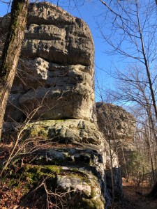
We soon see what attracted the Gills to this place as we enter a marvelous mingling of massive blocks of sandstone, a fantasyland where you expect a hobbit to peer around a corner at any moment. Erosion has washed away soil and less-resistant rock to reveal house-size stones. This has happened in several places on mountaintops scattered across the Plateau. From a distance, such a collection of stones appears to be a city, and so is often called a “rock city,” perhaps the most famous being the Rock City tourist destination on Lookout Mountain in Georgia, just southeast of Chattanooga.
The Cumberland Trail continues on, descending from Black Mountain and rising to traverse Brady Mountain. I’ve hiked these oldest sections several times over the years. North and west, these mountains frame Grassy Cove, one of the most beautiful valleys in the Southeast, although geologically speaking, the cove is a giant sinkhole. This is a karst region of underground drainage, sinkholes, and caves. All the water raining onto the surrounding mountains and draining into the cove gathers in Cove Creek, which enters a cave on the northeast and emerges on the other side of the Brady Mountain through Devilstep Hollow Cave. From there, the stream becomes the Sequatchie River that flows straight for 65 miles down Sequatchie Valley that separates Walden Ridge on the east from the main plateau tableland on the west. The 10,500 acres of the Grassy Cove Karst Area was designated a National Natural Landmark in 1973.

It’s a chilly morning after a December snowstorm. Most of the snow and ice have melted, but along the road layered icicles drape rock outcrops like melted candlewax. Sondra and I are headed into the Cumberland Mountains to enter North Cumberland Wildlife Management Area in search of elk. The WMA includes several units administered by the Tennessee Wildlife Resources Agency. Elk have long been absent Tennessee. In the Royal Blue Unit of the WMA, elk were reintroduced in 2000-2002, and then in the Sundquist Unit in 2003. An additional reintroduction in Royal Blue occurred in 2008. Total reintroduction is 200 elk.
While it’s been several years since the Tennessee elk reintroduction, we have not yet been to Hatfield Knob for a look at the Manitoban elk (Cervus canadensis manitobensis), a subspecies that’s sometimes referred to as “western” elk. The WMA’s reintroduced elk were brought from Elk Island National Park in Alberta, Canada, a population known to have the most disease-free elk. Manitoban elk are found in North Dakota but also the southern Canadian prairie regions of Saskatchewan, north-central Alberta, and Manitoba, and so the common name. Some elk also came from an enclosure at Land Between the Lakes to the west where the Tennessee and Cumberland Rivers nearly converge before joining the Ohio River, although those elk also originated at Elk Island.
The eastern elk subspecies (Cervus canadensis canadensis) once roamed open grasslands on the Plateau, as well as much of the eastern states. Grazing wildlife and burning by Native Americans kept these grasslands open; however, with encroachment of European Americans, wildlife was hunted and fires suppressed so that much of the prairie that provided forage grew up in forest. With overhunting and habitat loss, the eastern elk vanished. The last elk in Tennessee was reportedly killed in 1865. The very last known eastern elk was killed in Pennsylvania in 1877, and the U.S. Fish and Wildlife Service declared this subspecies extinct in 1880. So a close relative to the eastern elk had to be used for reintroduction.
Sondra and I have bit of a precarious drive. The dirt road into the Sundquist Unit of the North Cumberlands is still crunchy with ice where shade as prevented the sun’s warmth from reaching the roadbed. But then, where ice has melted the road has turned to mud, fortunately only two or three inches deep. Dropoffs to the right don’t help either as we slither a bit in the mire.
In about three miles, we take a right fork and travel another mile, ascending to a parking area and gate. On foot, we continue up the road, now gravel as it climbs Hatfield Knob. Just as we top out at an open field, several elk are grazing at a distance, most with their beige-colored rump turned toward us. In addition to “elk,” C. canadensis also has the common name “wapiti,” apparently a word of the indigeous Shawnee meaning “white rump.” Both the Cherokee (Ani-yun-wiya) and Shawnee (Shawano) once hunted the Plateau, which took its name from the Cumberland River (Wasioto). The elk all look to be females, for none has a set of antlers. While bulls will lose their antlers each year, it’s still a little early for that to have occurred.


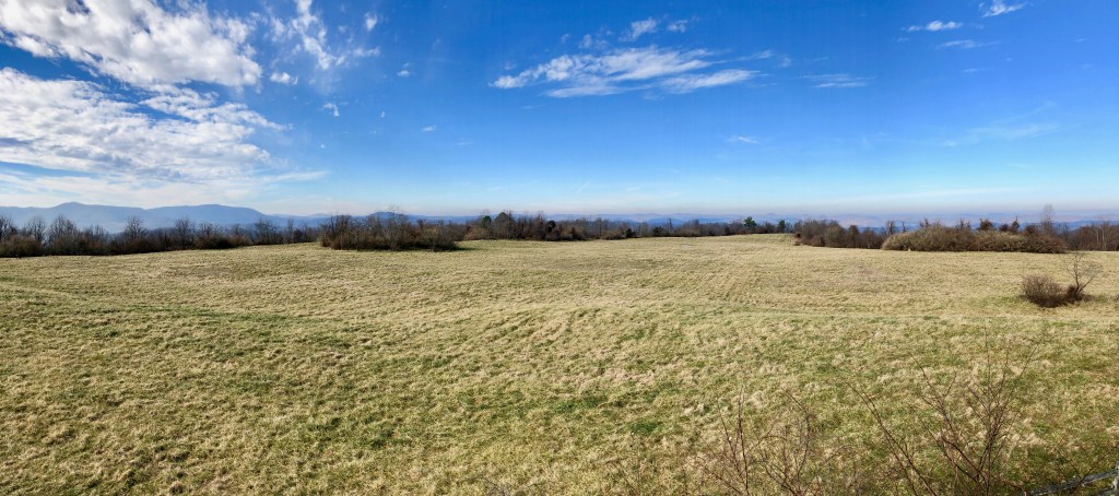
Only a few other spectators are around, but they turn to leave and so we’re left alone to continue on up to a viewing tower. Climbing the steps to the sheltered platform, we have a panoramic view of the grassland below us, which we later learn is a reclaimed coal stripmine where TWRA has recreated open prairie with surrounding forest and the Cumberland Mountains beyond.
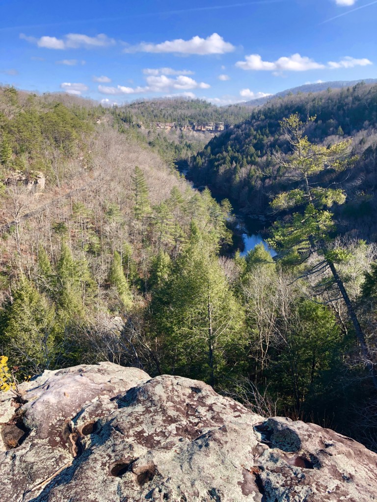
Now we’re at Lilly Bluff, overlooking the deep gorge of the Clear Creek tributary of the Obed River. The two streams plus portions of the Daddys Creek tributary and the Emory River that the Obed joins are designated a Wild and Scenic River managed by the National Park Service. Typical for gorges on the Cumberland Plateau, massive sandstone bluffs tower over forested slopes that incline to the stream’s edge.
At the Lilly Bluff Overlook, an elaborate boardwalk protects the fragile plant community that thrives on the flat sandstone atop the bluff. As much as I’ve explored the Cumberland Plateau, I have never encountered such an expanse of reindeer moss (Cladonia rangiferina), actually lichen, although moss-like in appearance. In the northern climes, the pale-green fibrous clumps are a primary food for caribou, and so the name “reindeer.” The lichen is extremely slow growing, only a few millimeters a year, and also fragile. It might survive one false step, but repeated trampling easily kills it. There’s evidence of that to the left near the overlook. Prior to the boardwalk being erected by the National Park Service, a path led from the parking area to the overlook. I walked that path many years ago, even before there was a road into a parking area. You can still see the path, brown with fallen pine needles passing through the green lichen.


Below the overlook, Clear Creek threads its way southeast to join the Obed, hidden behind a promontory that juts toward the confluence. In 2014, the Tennessee Chapter of the Nature Conservancy helped protect the scene by purchasing 63 acres on the prominent hilltop and bluff in the distance where Clear Creek passes from view, avoiding any development that would mar the natural setting. The area was donated to the park in 2018.
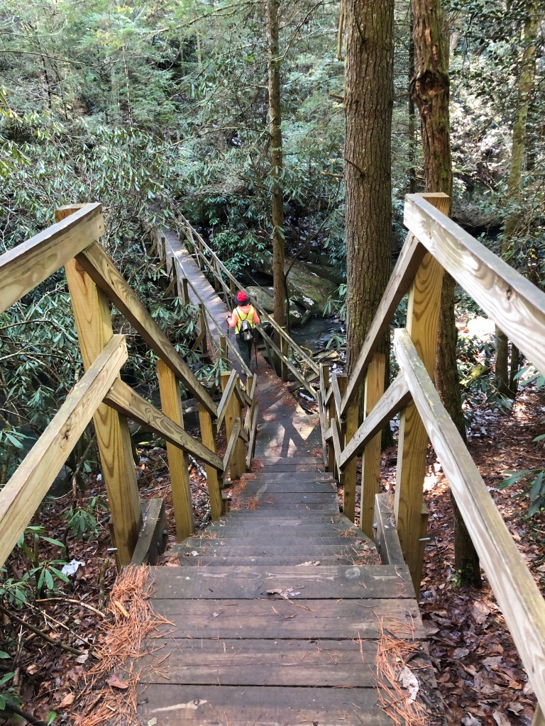
We aim to walk out “The Point,” as the promontory is called. So from the overlook, Sondra and I head out the Point Trail, passing through a dry upland forest of mostly pine trees and mountain laurel. The trail switchbacks down to a stairway and bridge crossing of Melton Mill Branch. An old gristmill likely operated along the upland portion of this creek, hence the name. The trail soon runs into a tall sandstone bluff where we hop onto a rock shelf and gingerly walk the shelf to then step up rocks and continue out the wedge of land between the river and the creek. We’re seeing some deciduous trees now that the trail has moved away from the bluff. It’s nearly winter, and the large fallen leaves of native magnolias litter the forest floor as if a large group picnic had left their paper plates scattered here and there. Occasional patches of miniature ground pine and ground cedar form Lilliputian forests beside the trail.
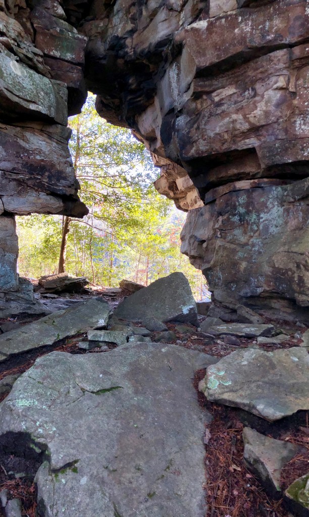
On out the promontory, we pass exposed blocks of stone where surrounding earth and rock have eroded away. Two huge boulders stand together, nearly touching. Then a natural sandstone arch, perhaps 15 feet high in the opening, standing just off the path.
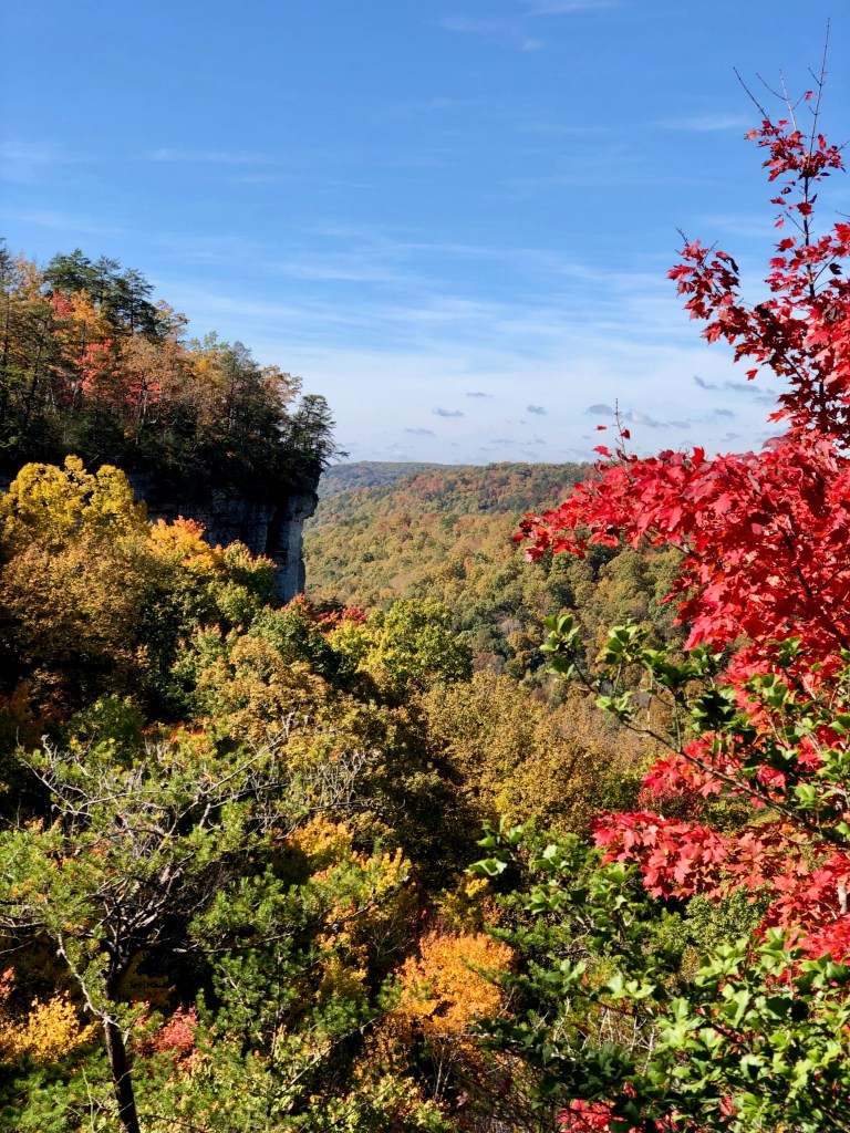
The trail turns east so that now we’re on a slope facing north, which allows more moisture to remain on the tableland than south-facing slopes. So here, rather than the mountain laurel found in dry areas, rhododendron line the trail. Both catawba and rosebay thrive on the plateau on such north-facing slopes and in cool hemlock coves. The promontory we’re walking continues to narrow so that it becomes quite obvious there’s a gorge on each side. Finally, reaching The Point we see the two canyons converging, but the actual confluence is lost in the trees that adorn the slope down from the bluff. The best views turn out to be on the Obed River side where we peer down 500 feet to the stream below, nearly occluded with fallen boulders
The Nature Conservancy in 2005 purchased the 3,720-acre Pogue Creek Tract that lies next to Pickett State Park and Forest, completing a 25,000-acre “Greater” Pickett that is contiguous with the 708,000-acre Daniel Boone National Forest to the north and the 125,000-acre Big South Fork National River and Recreation Area to the east. In 2006, the State of Tennessee purchased 3,000 acres of TNC lands to create the Pogue Creek Canyon Class II Natural-Scientific State Natural Area, the highest ranking for Tennessee natural areas because of the significant geological and natural features.
As the years passed, I somehow did not get around to hiking Pogue Creek Canyon. So now was the time. I forego the easier access off Hwy 154 and turn on the gravel Black House Mountain Road to a trail crossing where the Moccasin Rock Trail emerges from Pickett State Forest on the right. A small muddy parking area on the left provides access into Pogue Creek Canyon SNA, but there’s no sign indicating this is a trailhead. I suspect signage and better parking will be provided in the future.
The Mesa Top Trail begins on an old roadbed, graveled at first but then turning to a forested path as it heads out across the “mesa,” actually a ridgeline that leads west. Sand underfoot indicates approach to sandstone bluffs characteristic of Cumberland Plateau canyons. And, I begin to glimpse the canyon. Wooden stairways assist in negotiating a gap in the sandstone ridge as the trail drops into the gap and ascends the opposite side. The trail then continues out the ridgeline to 180-degree views of Pogue Creek Canyon. It’s fall of the year, and so the forest has a dusting of reds and yellows. Somewhere deep in the canyon below tall sandstone bluffs, Pogue Creek flows west to join the Wolf River.


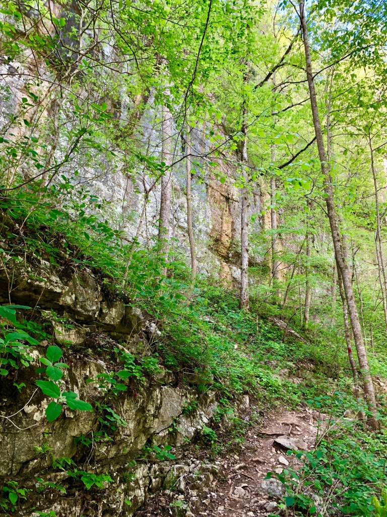
Back along the ridge and dropping into the gap once again, I turn on the Upper Canyon Trail that passes below the bluff, 200 to 300 feet of sandstone wall, some of the tallest I’ve hiked past on my many years of exploring the Plateau. The trail skirts the sheer bluff that sometimes protrudes overhead to pass through Kildeer Arch. Still along the bluff, the trail swings left into an alcove to cross a tributary stream on a wooden bridge with a small waterfall to the left.


At a junction, a shortcut leads straight ahead, toward the parking area. A right turn on the Upper Canyon Trail leads out a small side ridge to soon drop off to the left in a series of switchbacks down to a more substantial tributary of Pogue Creek. The trail leads along the cascading tributary to a crossing just before its junction with the creek. The Upper Canyon Trail continues upstream along Pogue Creek to a crossing and a climb out of the canyon to connect with the Overlook Trail loop that leads out to the established trailhead on Hwy 154. But I need to get back to my car, so I save that route for another time and head up the shortcut to connect with the Mesa Top Trail and back to Black House Mountain Road.

Denny Cove, another of the more recently preserved areas, had for some time attracted our attention. So on the last few clear days of late autumn, Sondra and I head for the South Cumberland Recreation Area, now a designated state park. The South Cumberland is perhaps our favorite place on the Plateau and we’ve been here often.
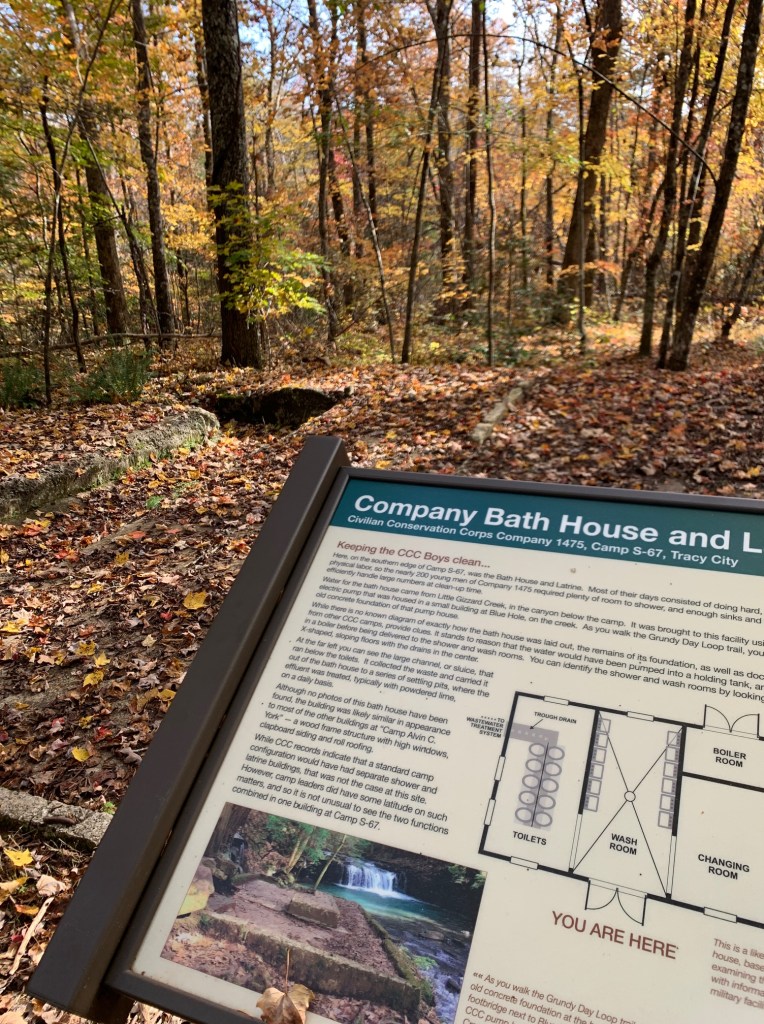
On the Grundy Forest Day Loop, our obligatory first hike whenever we visit, we cross a small creek with a waterfall to the left and then explore the new Civilian Conservation Corps interpretive loop spearheaded by the Friends of the South Cumberland State Park. CCC Company 1475 had a camp here in the 1930s that consisted of several buildings. The men of the camp, among many projects, helped build some of the trails in the region that would become the park.
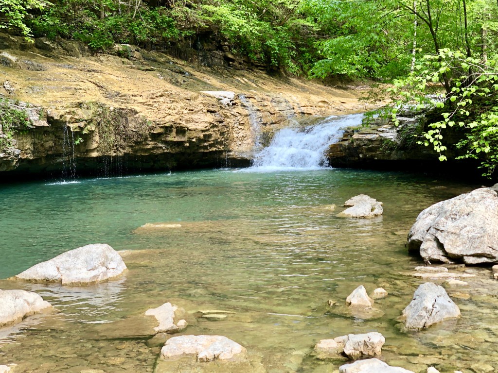
We soon descend into the small gorge of the Big Fiery Gizzard Creek and wander downstream as the water skips and slides under a sun-filtering canopy. Near the confluence of the Little Fiery Gizzard Creek with Big Fiery Gizzard, the Fiery Gizzard Trail continues down the main creek, rated one of the best trails in the Southeast. Circling back along Little Fiery Gizzard, we pass Blue Hole Falls and then climb to complete the loop.

The next day, we head to Denny Cove. In 2016, a coalition of conservation organizations, led by the Southeastern Climbers Coalition and the Access Fund, which works to preserve access to climbing landscapes, purchased the Denny Cove area from a timber investment company. The State of Tennessee purchased the property from SCC later that year, and in 2017 Denny Cove was added to the South Cumberland State Park, a unique combination of eight separate units that with the addition of Denny Cove now totals 30,845 acres.
Herman Baggenstoss, chair of the Grundy County Conservation Board, and who in the 1930s was with the U.S. Forest Service and served as project manager for the CCC crews, worked tirelessly to promote the idea of a state park protecting the magnificent sandstone canyons of the region. The State of Tennessee was initially reluctant to designate the various proposed areas as state parks because individually they were perhaps too small. But Baggenstoss convinced the state to combine the areas into a single park, which has since become the premier park in Tennessee for wilderness hiking and rock climbing. In my early years of exploring the South Cumberland, I would often visit with Herman for tidbits of history and, every time, stop in the Dutch Maid Bakery in Tracy City, where brother Albert was baker, for some fresh-baked cookies. Originally the “Baggenstoss Bakery,” founded by Swiss immigrants John and Louise, the Dutch Maid continued operation under their six sons, including Herman and Albert. All the brothers are gone now, but the bakery is still in operation.
So after stopping in for a dozen cookies, Sondra and I arrive at the trailhead for Denny Cove. The level access trail from the parking area belies the difficult trek beyond.
Beginning the drop below the sandstone bluff, we reach an intersection for the Climbers’ Access Trail that leads up left for access to multiple climbing routes on the cliff face. Not climbers ourselves, we stick to the lower Waterfall Trail that threads the forest below the bluff. We eventually encounter crossings of boulder fields, with difficulty stepping from rock to rock with only intermittent breaks along stretches of easier path.
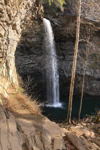
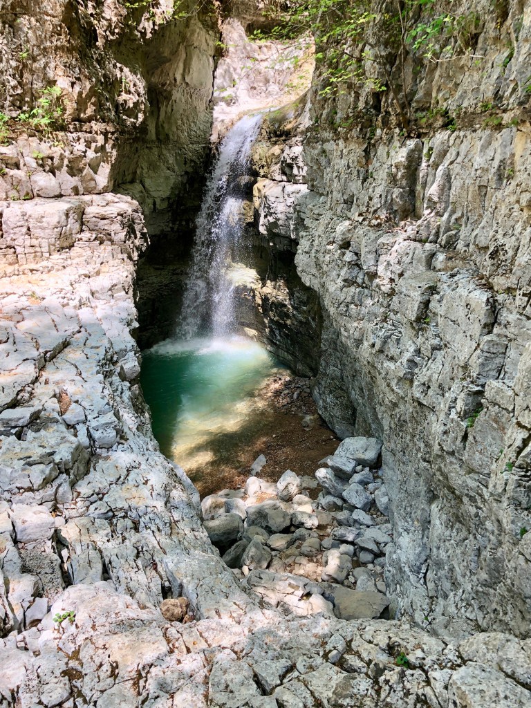
But we persist across the jumbled boulders and reach trail’s end at Denny Cove Falls, a 70-foot waterfall where Denny Cove Branch streams down the rock face and droplets prism the sunlight into a bow of colors. The curtain of water falls within a 180-degree amphitheater before tumbling on down the cove to eventually join Little Gizzard Creek in the larger gorge beyond.

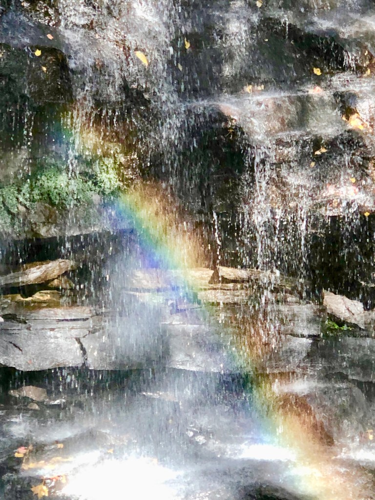

Denny Cove Falls
I first heard of a fabled gorge on the Cumberland Plateau while Sondra and I were working on the first edition of our book Tennessee’s South Cumberland, which included trails in and around University of the South at Sewanee that rests on the southern Plateau. We picked up a copy of an old book at the university bookstore titled Under the Sun at Sewanee, first published in 1967 and updated in 1978 to provide a guide to outdoor activities for students and faculty at the university. We found buried in a section called “Hikes and Picnics … And Yon” a short description of The Walls of Jericho:
… a unique geological formation, featuring 150-200 foot vertical cherty limestone walls rising above a creek that flows over alternating small falls, pools, and smooth bottoms. Near the top the walls are very close together and the canyon is a stark, striking U-shaped limestone ampitheater (sic) with several levels ending in a fifty-foot deep sinkhole into which the creek flows during wet weather.
The area that includes The Walls of Jericho straddles the Tennessee-Alabama state line. Unfortunately a private timber company closed access to the area about the time the second edition of Under the Sun was published. All who knew of “The Walls,” and had perhaps hiked it in the past, had to wait almost three decades to regain access. Once again, The Nature Conservancy came to the rescue. The efforts of the Alabama and Tennessee TNC Chapters working together resulted in the purchase of 21,453 acres in 2004 that includes the headwaters of the Paint Rock River. Not long after, Alabama’s Forever Wild Program purchased 12,500 acres on the Alabama side and joined it with adjacent property to the south to expand the existing Skyline Wildlife Management Area to 60,000 acres. In 2006, a federal Forest Legacy Program grant enabled transfer of the TNC acreage on the Tennessee side to TWRA. The Tennessee Division of Natural Resources now co-manages the core 750 acres that includes the legendary gorge as the Walls of Jericho State Natural Area.
I was eager to see this Cumberland Plateau gorge, and not yet having been there, I joined Sara Pollard for a hike into The Walls. Sara is a hike leader with Tennessee Trails Association’s Murfreesboro Chapter and has hiked to The Walls with groups several times over the years since its reopening. “We’ll meet at the Tennessee side trailhead at 8:00 am Central Time,” Sara said. “Going in on the Tennessee side is a gradual descent, but coming out on the Alabama side is steep but shorter. We should see lots of wildflowers.” I met Sara at the trailhead, and since we planned to hike in from here and emerge at the Alabama trailhead, we first ran a shuttle, leaving a car at the southern end.
Then on this bright April day, we begin our descent into the gorge, passing myriad colors of wildflowers scattered on the forest floor. Stepping lightly on the rocky path, we cross whispering trickles and dry washes in our descent toward Mill Creek. Somewhere unnoticed on the other side of the stream, Mill Creek has joined Hurricane Creek from the north, which flows southwest to eventually empty into Paint Rock River, a primary tributary of the Tennessee River. A substantial bridge takes us across Hurricane Creek and soon after a second bridge spans the tributary Turkey Creek. Now the trail begins to enter the “box canyon” created by Turkey Creek. Sara, in the lead, turns to me, “Look at the walls, which is why it’s called ‘The Walls of Jericho.’” I look up from being careful where I step on the rocky path to see rock walls towering 200 or more feet to either side of us.
The gorge narrows until we’re wedged between the cliff on our left and the creek to the right where it slips down a smooth slide of rock. A small waterfall ahead drains the upper reaches of the box canyon into a large pool below. Crossing a shallow side stream of the creek, I notice nodules in the rock, which are cherts, microcrystalline quartz (silicon dioxide) also called “flint,” laid down when this region was once ocean, and so the rock here was termed “cherty limestone.”
Reaching the main outpour from the pool we rockhop the creek to the other side. A rock ledge leads above the waterfall into a grand amphitheater, a U-shaped limestone depression with cliff walls to either side reaching toward the sky. A rapid stream emerges from a cave, forming a cascade that splashes down to the waterfall and pool below.

After a quick lunch as we sit on a bench of the amphitheater, I want to explore to the end of the gorge where Sara says there’s another waterfall. I find handholds in the limestone ledge and haul myself up to the next level and scramble along the limestone creekbed. Water is not flowing here, but I’ve heard that after a recent rain the water spills down and spouts from holes in the limestone rock.
At the end of the box canyon, the creek streams down a ledge into a blue-green pool at the bottom of a deep break in the limestone. From there the water flows through rock and emerges from the cave below.
The Walls of Jericho does not disappoint. All I have heard about this extraordinary place has been confirmed. Preservation of such special places on the Cumberland Plateau, and their gradual joining—perhaps for the forest, perhaps for the geology, perhaps just for recreation—is also creating a wildlife corridor. This essential link in the Eastern Wildway allows wildlife to move freely in response to climate change and in their annual migrations in search of food and home.
© Russ Manning. All Rights Reserved.
An ebook of much longer text and complete references for Cumberland Plateau can be downloaded from amazon.com.