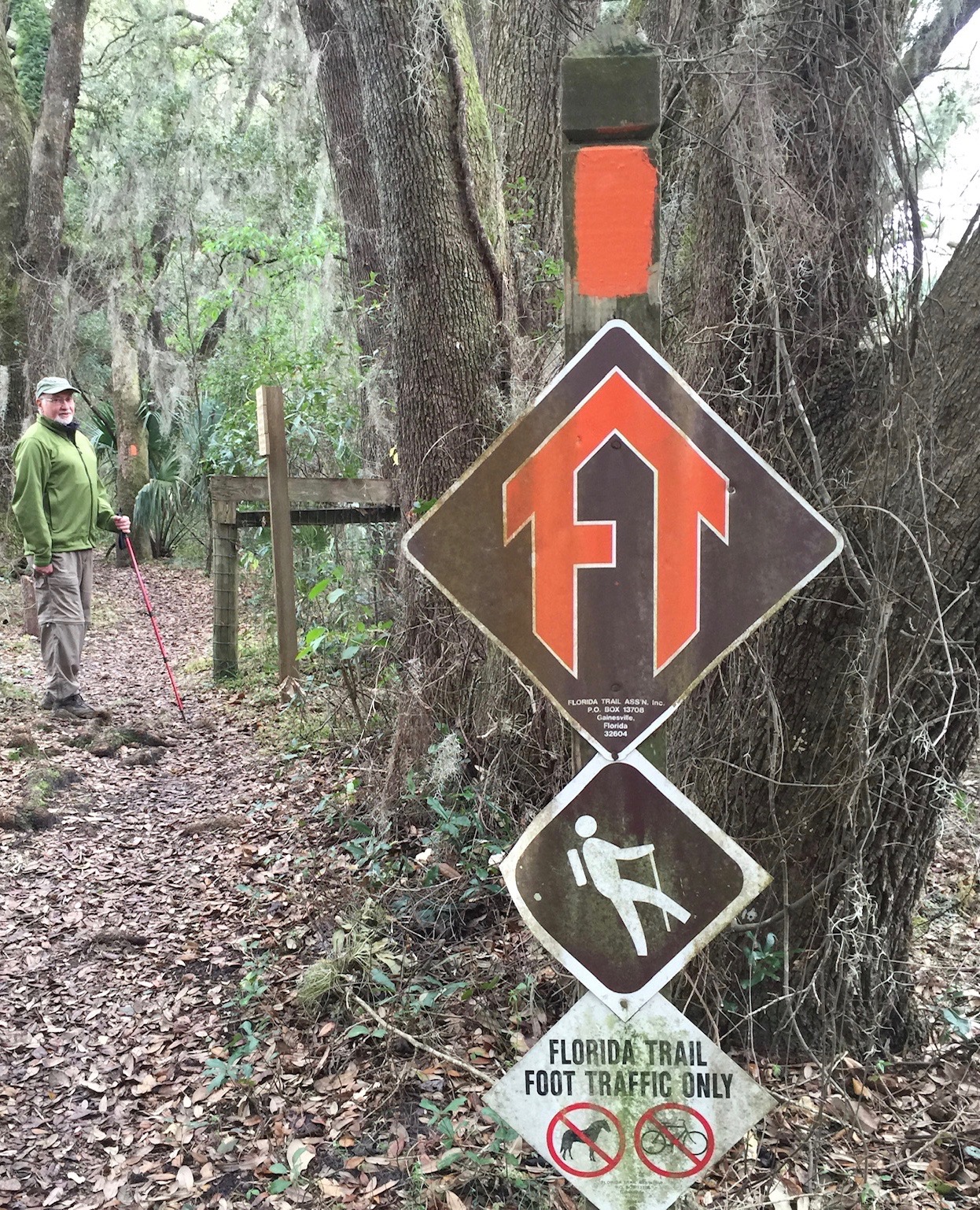
The Florida Trail leads through a hummock of saw palmetto and yaupon beneath tall cabbage palms and great live oaks whose fern-covered limbs drag the ground like the arms of great apes.
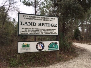
We’re here to see the Land Bridge over I-75, one of the first land bridges in the U.S., constructed in 1999 – 2000 just south of the city of Ocala. Although the impetus for the bridge was to connect trail systems on either side of the interstate, wildlife connection has become equal in importance to its use as a recreational bridge.
In the middle of the Florida peninsula, the FT splits into an Eastern Corridor that travels north, roughly in the wildlife corridor linking Okefenokee to Okeechobee, and a Western Corridor that loops west through several forest preserves and turns east at Citrus Springs to cross I-75 on the Land Bridge, reconnecting with the Eastern Corridor in Ocala National Forest. The Okefenokee to Okeechobee wildlife corridor, or O2O as it’s sometimes called (see sidebar “Three O2O Corridors”), is the southern-most link in an Eastern Wildway© proposed by the Wildlands Network™. Stretching from the Florida Keys north through the eastern U.S., the Eastern Wildway crosses the Canadian border into Quebec’s Gaspé Peninsula.
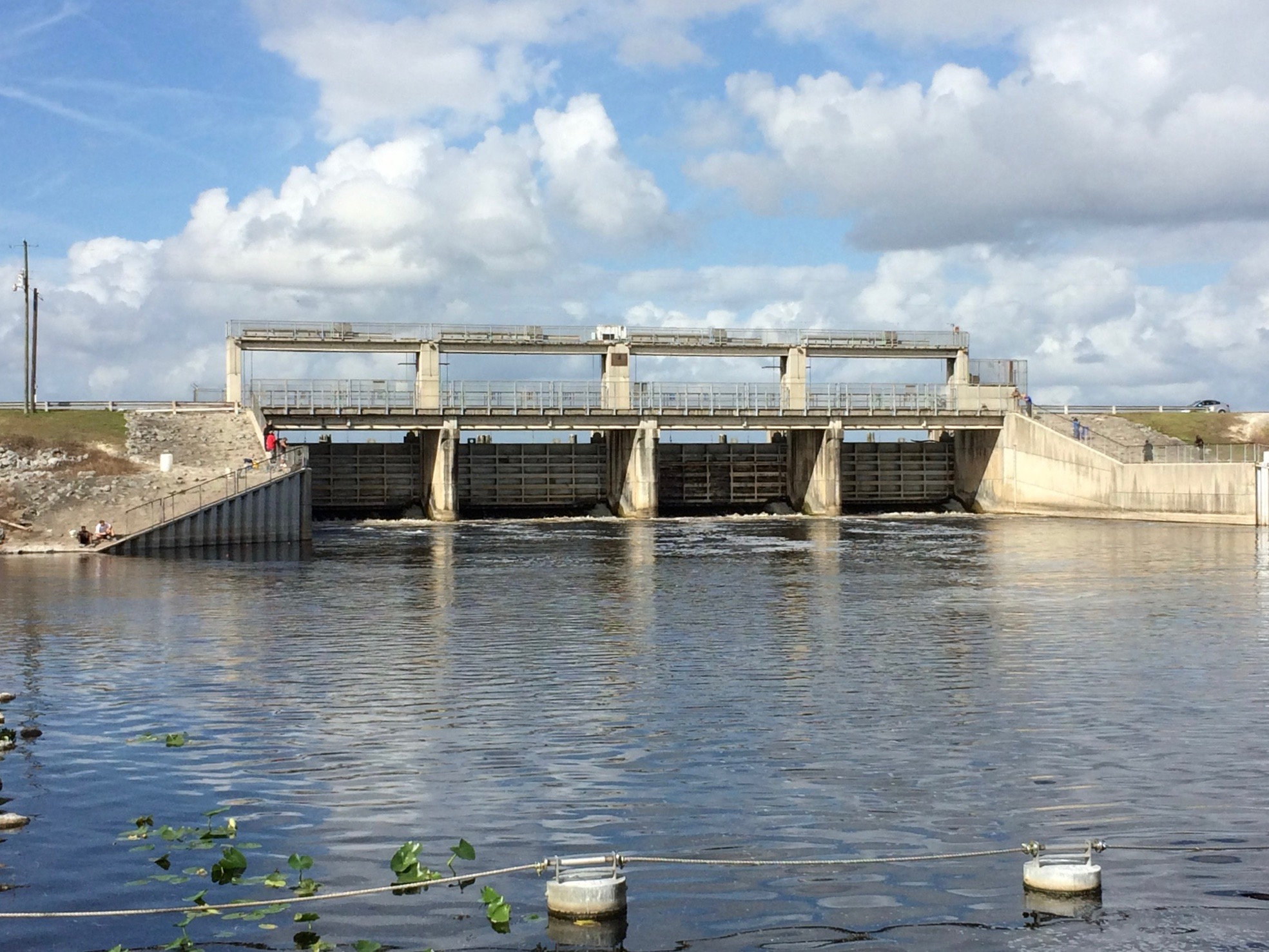
The drone of interstate traffic can be heard long before the FT joins a wide sandy path with fences on either side to funnel people and animals to the Land Bridge over I-75.
Rock walls on both sides of the bridge hold planted vegetation, and behind the plantings stand fences with more vegetation on the outside. Locked gates in the fences provide access for workers to maintain the outside vegetation as well as that on the inside.
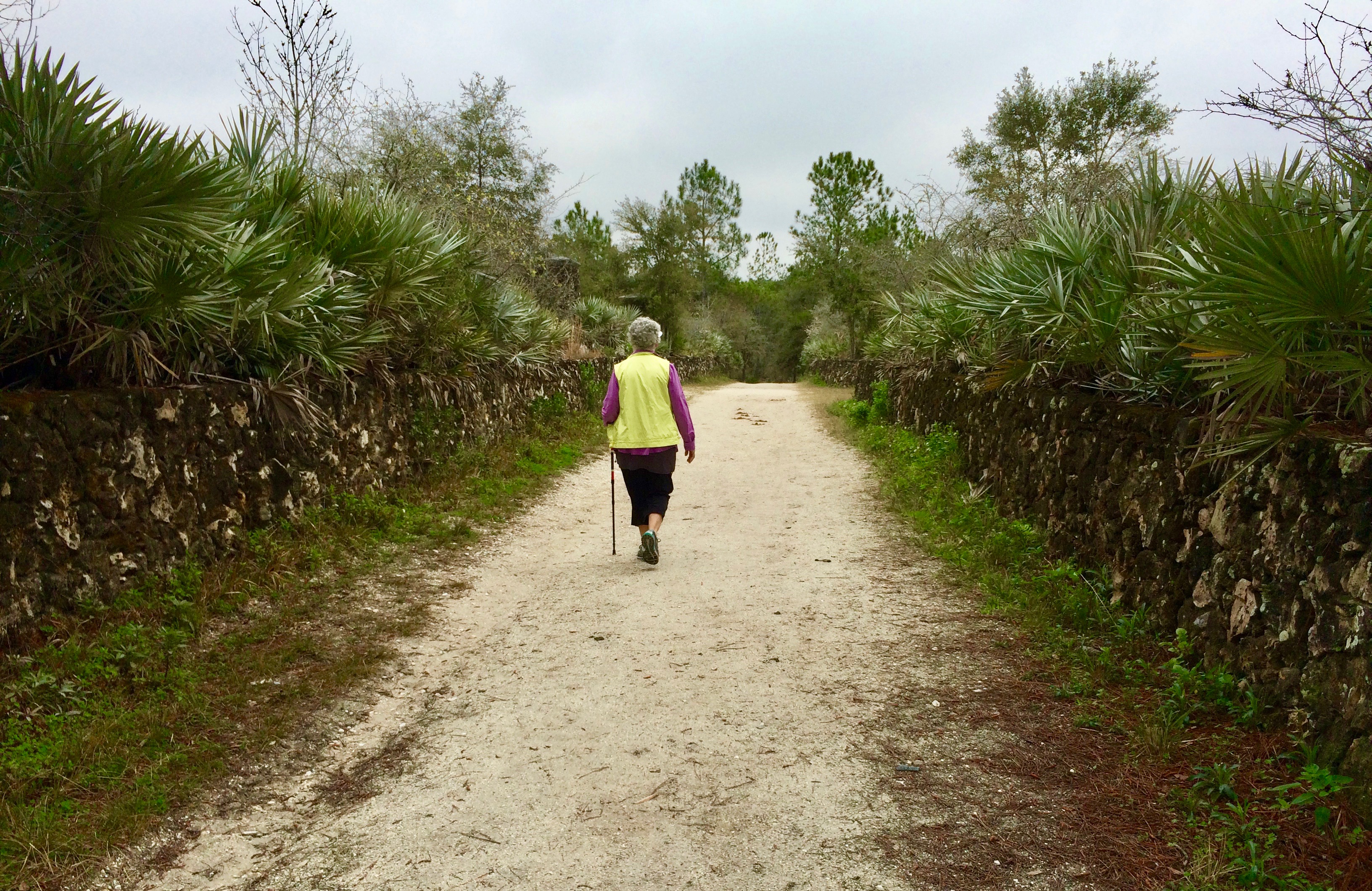
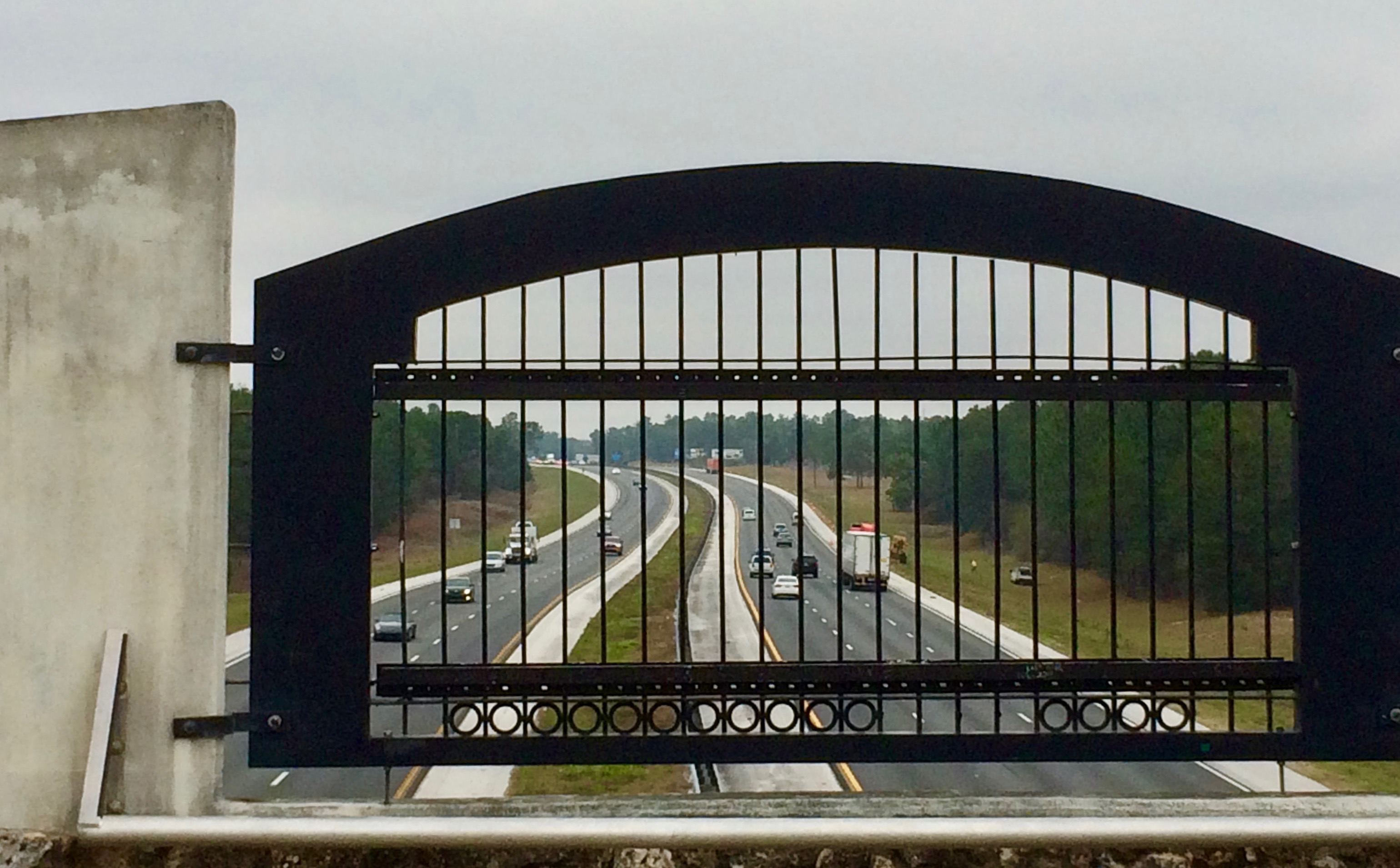

With all the shrubbery, the bridge is essentially a planter, based on a concept from the Netherlands where such bridges, and also underpasses, are termed “ecoducts.” The path across the bridge runs on a level below the walled vegetation to either side. So, except for the sound of interstate traffic, an animal crossing the bridge would not be aware of passing over the interstate.
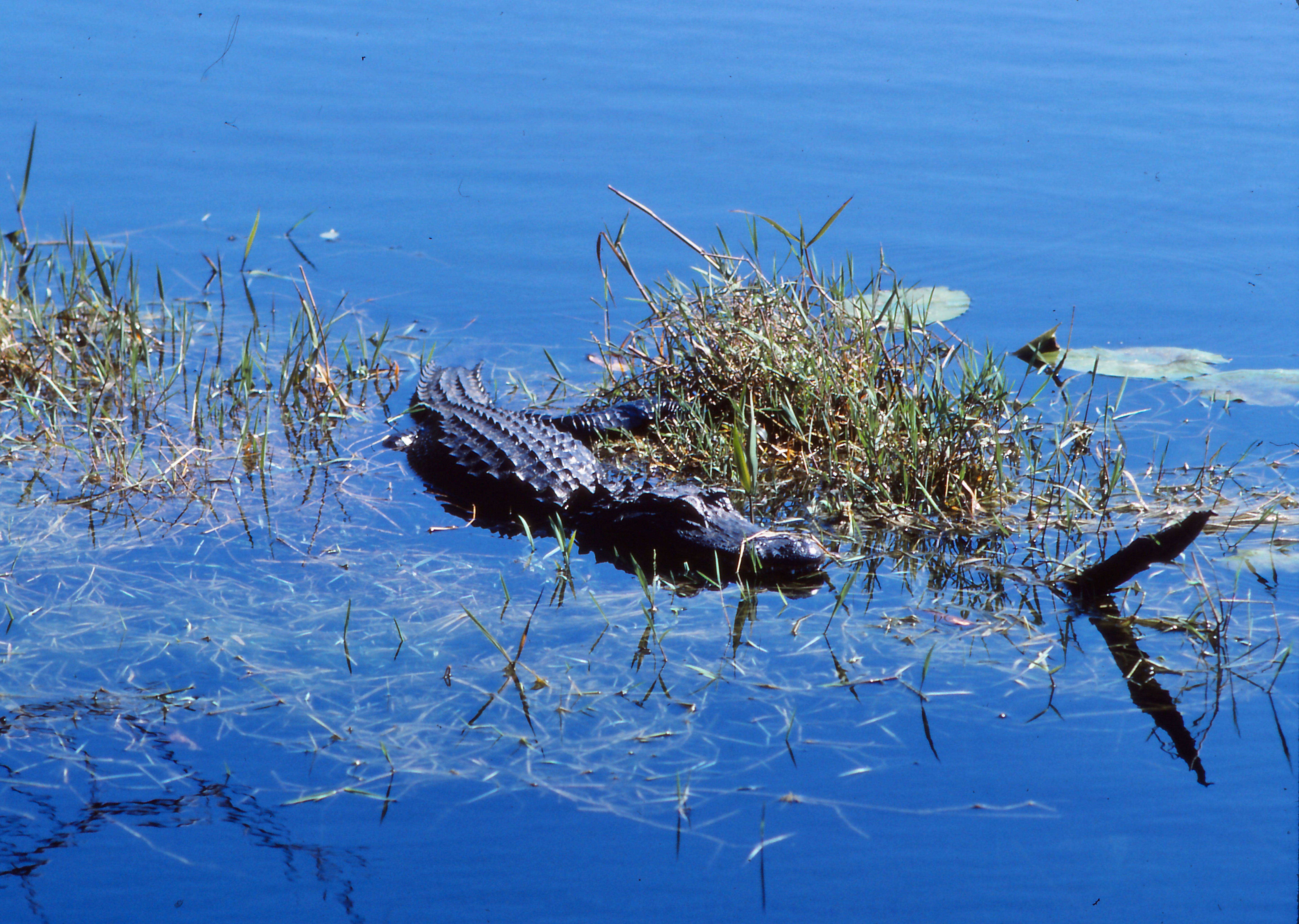
Animals most likely cross at night, or especially at dusk and dawn. So we take turns—diurnal humans using the bridge during the day, and nocturnal animals using the bridge at night after we have left. One account notes sightings of cougar on both sides of the interstate that would surely have used the bridge, certainly if the sightings were of the same cat. The cougar had to have been a member of the Florida panther population (Puma concolor corryi) that hides out in the forests and swamps of southern Florida, separated from other cougar populations.
The cougar (Puma concolor), along with other predators, was eradicated over much of its eastern range by the late 1800s. The few cougars that remained in south Florida after eradication in the east, and isolated from the remaining populations in the west, developed the genetic differences that led to its designation as a subspecies. While the cougar is known by many names (mountain lion, catamount), the Florida cougar is almost always called “panther.”
Most Florida panthers are found south of the Caloosahatchee River that runs west from Lake Okeechobee, part of the Okeechobee Waterway providing navigation across the Florida peninsula for recreation and light commercial boats. The Caloosahatchee seems to be a barrier for female panthers since nearly all sightings north of the river have been males, which range much farther than females. However, in March 2017 a wildlife camera photographed a mother with kittens north of the river, the first time in forty years that breeding north of the river was documented. In 2008, a male made it all the way into southern Georgia—but was promptly shot.

So the panther, or panthers, sighted on either side of the Land Bridge was most likely male. We examine the sandy path for any panther prints. Unfortunately, hikers have already come this way today and so any depressions left in the loose sand have been lost.
The Land Bridge provides a link in the 110-mile Marjorie Harris Carr Cross Florida Greenway, named to honor the leader of the opposition to a proposed Cross Florida Barge Canal. The idea for a canal arose as early as 1820 when shipping was the primary form of transportation. Not much was done until 1964 when the U.S. Congress appropriated funds to start serious construction, although by then the need for a canal was at best questionable.
Marjorie Carr, wife of famed ecologist Archie Carr and a zoologist/ecologist in her own right, first worked with the Alachua Audubon Society and then in 1969 helped found Florida Defenders of the Environment to oppose the Cross Florida Barge Canal, arguing that it would destroy much of the native landscape of central Florida. Opposition by the Florida Defenders and increasing doubts about the benefits of the canal finally resulted in a Federal judge placing an injunction on the project in January 1971, but not until 1990 did the U.S. Congress formally cancel the project. Unfortunately, Rodman Dam on the Ocklawaha River, a tributary of the St. Johns River, had been completed and was closed on September 30, 1968, backing up 16 miles of the river and forming Rodman Reservoir. A canal linking the reservoir with the St. Johns had also been completed with the associated Buckman Lock.
The lands that had been acquired by the federal government for the barge canal were returned to the state. The corridor at first became the “Cross Florida Greenway State Recreation and Conservation Area” but was later renamed for Carr, who more than any other had saved the central Florida environment.
Rodman Dam, later renamed George Kirkpatrick Dam for the state senator who relentlessly pushed for the dam and canal, still stands as an obstacle to a free-flowing Ocklawaha River that forms the northern and eastern boundary of Ocala National Forest. Peggy MacDonald, in Marjorie Harris Carr, Defender of Florida’s Environment, reports that following Carr’s funeral in 1997 a “Free the Ocklawaha” sticker was in full view on the back of the hearse as it drove away. A few years later, a “Save Rodman Reservoir” sticker adorned Kirkpatrick’s casket.
Okay, I have to see this dam that has been the center of so much controversy. Wife, Sondra, and I head south from the town of Palatka on State Route 19. A sign on the left directs us to Buckman Lock on the artificial canal that was dug straight as an arrow to connect Rodman Reservoir with the St. Johns River. The lock lifts boats from the water level of the river to the level of the reservoir. Shading my eyes from the bright sun, I see a couple of recreational boats headed to the reservoir in the distance.
SR 19 then mounts a high bridge over the canal, high enough for the imagined barge traffic that would have used the canal. Then a right on Rodman Dam Road at a sign for the greenway, passing through dense forest on both sides of the road. The Florida Trail has made it’s way north through Ocala National Forest and emerges to cross the road.
The forest then gives way to a blasted landscape of bare dirt and rock surrounding a snag-filled reservoir. People are sitting in lawn chairs or standing at the water’s edge, fishing. A couple of boats are out there, but they must move slowly to avoid the floating logs, some still anchored to the bottom. Turns out the U.S. Army Corps of Engineers, who had the job of building the canal, used a tree crusher specially designed to prepare the 10,000-acre reservoir. The huge amphibious machine, resembling a tank, moved through the river valley pushing trees over and driving them into the ground, where they were supposed to stay after being covered with the lake water. The “Crusher Crawler,” as it was called, was faster than a logging operation, able to push trees over and into the ground at the rate of an acre an hour. Problem was, the Corps’ engineers somehow forgot that most wood is less dense than water. So once the water backed up from the closed dam, the muddy bottom released the submerged trees.

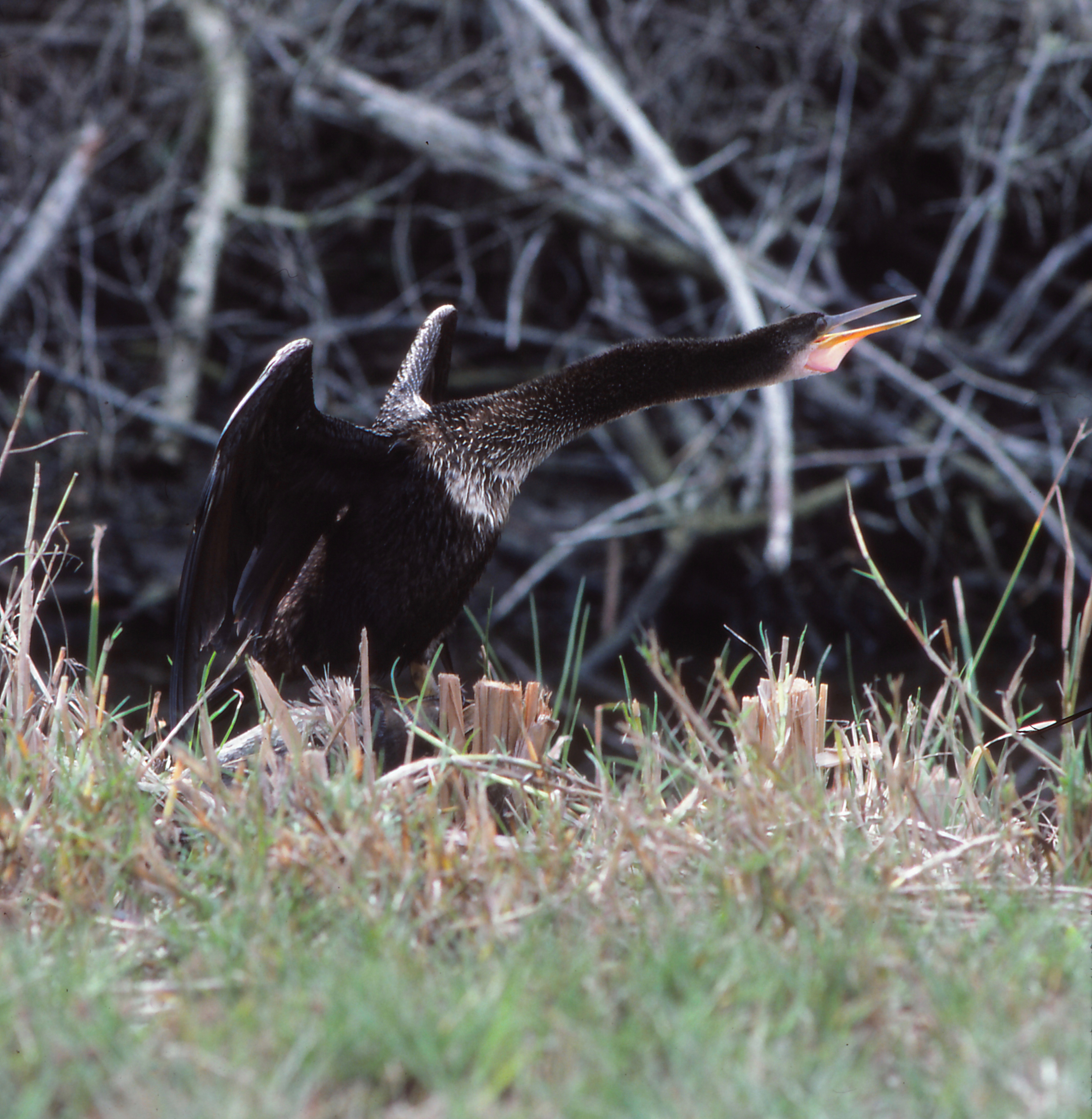
The road crosses the top of the dam, so we drive on across to a side road that turns down toward the bottom of the dam, passing along an old meander of the Ocklawaha that has been cut off by the outflow from the dam. The road ends at the river near the bottom of the dam where the lake water gushes out and flows on down the Ocklawaha to its confluence with the St. Johns. People with fishing poles expectantly wait for bass to come through, as do double-crested cormorants (Phalacrocorax auritus) perched on nearby floats.
Not much of a dam, as far as dams go—an earthen dam with a water gate. Wouldn’t take much to knock the gate out and bulldoze a channel to let the river run free again. There are opinions, and websites, on both sides of the issue. Those who want to keep the dam have found the snag-infested reservoir makes good habitat for bass. Those who call for dam removal want the Ocklawaha River returned to its natural ecological balance and to save the annual operating cost for the dam and reservoir. For now, folks are enjoying the bass fishing.
With most of Florida’s population living along the coast, and despite the urban areas of Gainesville, Tallahassee, and the excessive development around Orlando, much of the interior of the state has potential for a Florida Wildlife Corridor through a combination of millions of acres of federal and state lands plus even more acreage in pine plantations, farms, and cattle ranches. The vision of a wildlife corridor running the length of the state has been around a long time.
Despite Florida’s usual conservative politics, the state recognized water and wildlife resources were imperiled with the encroachment of rampant development and, in 1990, enacted Preservation 2000. During the ten years of the program, funds were provided for land acquisition through a fee on real estate transactions; about 2.4 million acres were acquired. The program was such a great success that the legislature passed the Florida Forever Act to pick up at the end of Preservation 2000. The act declares,
The state must play a major role in the recovery and management of its imperiled species through the acquisition, restoration, enhancement, and management of ecosystems that can support the major life functions of such species. It is the intent of the Legislature to support local, state, and federal programs that result in net benefit to imperiled species habitat by providing public and private land owners meaningful incentives for acquiring, restoring, managing, and repopulating habitats for imperiled species.
Reminiscent of the Adirondack’s “forever wild,” Florida Forever has since acquired over 700,000 acres with funding from real estate fees and bond issues, and perhaps controversially, land sales and exchanges. In November 2014, 75% of voters in Florida approved an amendment to the state constitution directing one-third of excise tax on documents to conservation land acquisition over the next 20 years; however, the measure has been underfunded.
In 2000, the citizens of Volusia County, north of Orlando, voted to tax themselves to protect the natural environment of the county. Since then, Volusia Forever has protected 38,000 acres either through acquisition or easements, adding to the Volusia Conservation Corridor. The proposed 200-mile corridor, in Flagler County as well as Volusia, will provide passage for bear, deer, perhaps panther someday between Daytona on the coast and Orlando, providing an essential link in the Okefenokee to Okeechobee corridor.
For just a taste of the Volusia Corridor, we head to Lake Ashby, one of the protected areas within the corridor. Turned the wrong way at first on 415, but heading back south we spot Lake Ashby Road and then turn on Boy Scout Camp Road through an oak hummock to the park entrance. A path leads to an impressive boardwalk out on Lake Ashby. Clouds reflect from the blue water dotted with lilies. Cypress lines the shore. Herons stalk the shallows.
Most planning for a Florida Wildlife Corridor is based on the Florida Ecological Greenways Network developed by the University of Florida in 1995. The Florida Department of Environmental Protection tasked the university with developing a model using Geographic Information System (GIS) software to identify areas of significant ecological and natural resource areas and the necessary linkages between those areas to form a functional statewide network. Updated periodically, with of course some areas designated as higher priority, the Network now guides land acquisition planning for DEP’s Office of Greenways and Trails and the Florida Forever program. In total, 50% of the state was found to have potential for inclusion, neatly fitting with the concept of “Half-Earth”—that we must set aside half the earth for other species if we hope to survive ourselves—the brainchild of famed biologist E.O. Wilson in his book, Half-Earth, although the name was coined by Tony Hiss in a 2014 Smithsonian article about Wilson’s idea.
A new group has emerged to bring more public attention to such restoration efforts. A Florida Wildlife Corridor initiative was founded in 2010 by Tom Hoctor with UF’s GeoPlan Center, conservation photographer Carlton Ward, Jr., and Richard Hilsenbeck with the Florida Chapter of The Nature Conservancy.
To demonstrate that a wildlife corridor still exists, but also to identify areas where the corridor is in danger of fragmentation, the initiative mounted two expeditions. In 2012, Ward was joined by Mallory Lykes Dimmitt, conservationist and seventh generation member of the Lykes family, one of the major landowners in state; bear researcher Joe Guthrie; and filmmaker Elam Stoltzfus on an astonishing thousand-mile journey in 100 days by kayak, backpack, horse, and bicycle from the Everglades north to Okefenokee (see sidebar “The Everglades”). But even more incredible, Ward, Dimmitt, and Stoltfus with another film crew and supporters, did it again in 2015—a thousand miles, this time in 70 days, from Everglades Headwaters National Wildlife Refuge, just south of Orlando, northwest to the Gulf Coast and into the Florida panhandle to Gulf Islands National Seashore. The trips are documented in their photographic books, Florida Wildlife Corridor Expedition, Everglades to Okefenokee and The Forgotten Coast, Florida Wildlife Corridor Glades to Gulf Expedition. By making these treks on the ground or water where an animal might go, they showed the potential for reconnecting habitat.
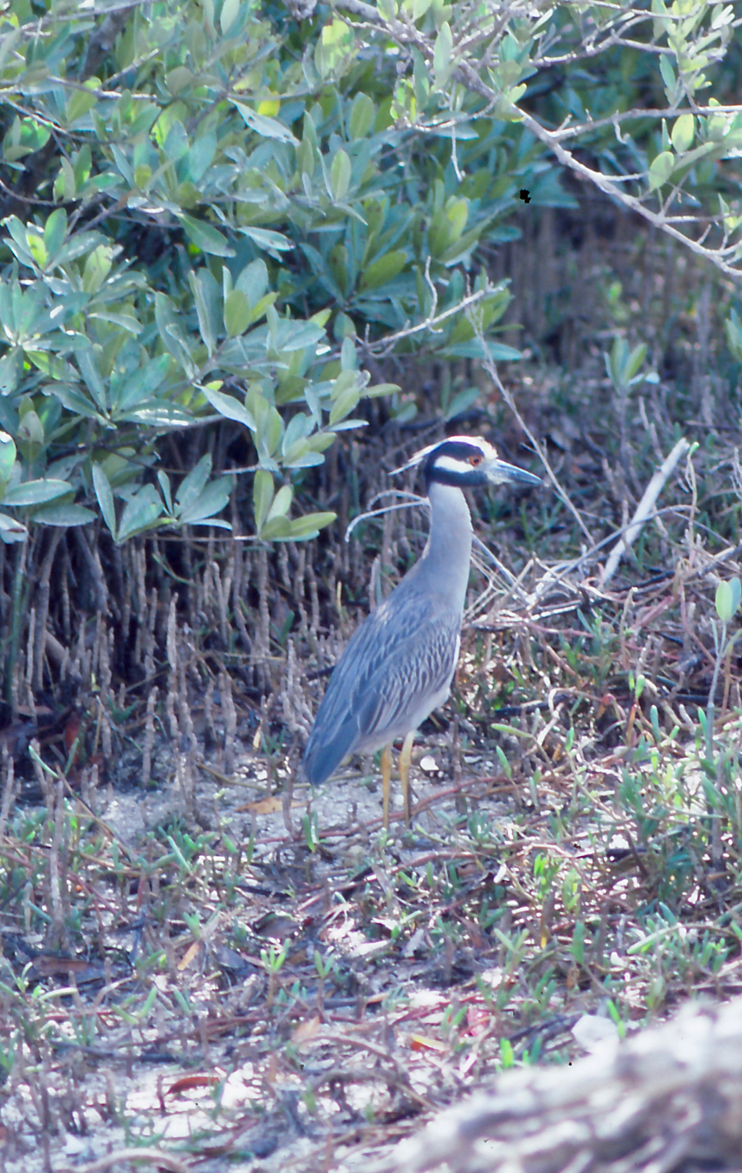
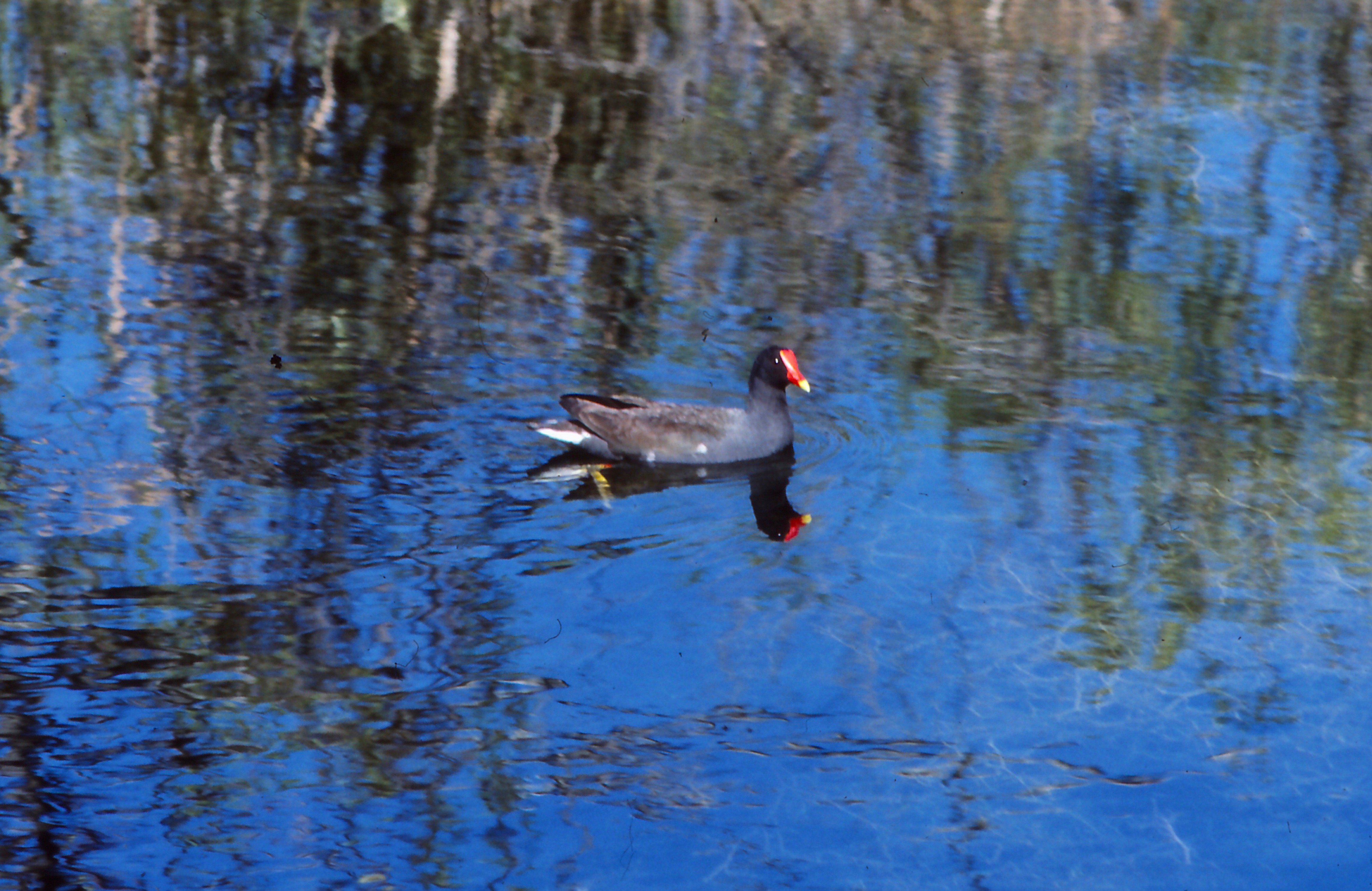

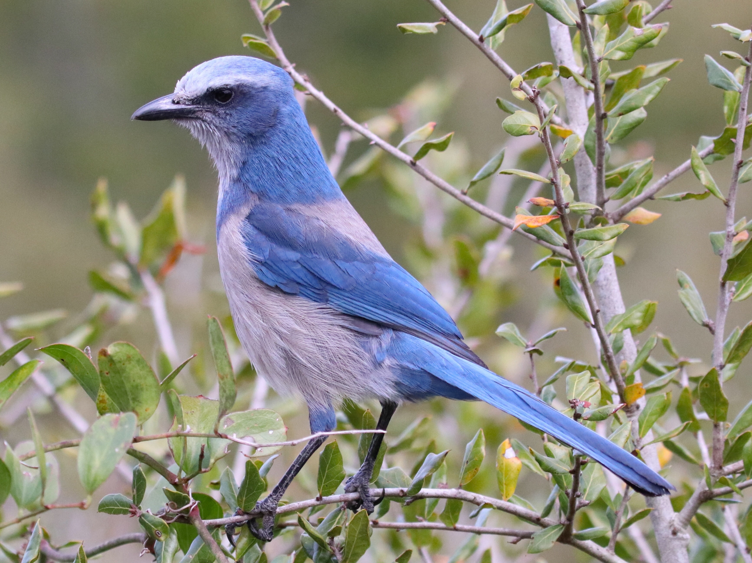

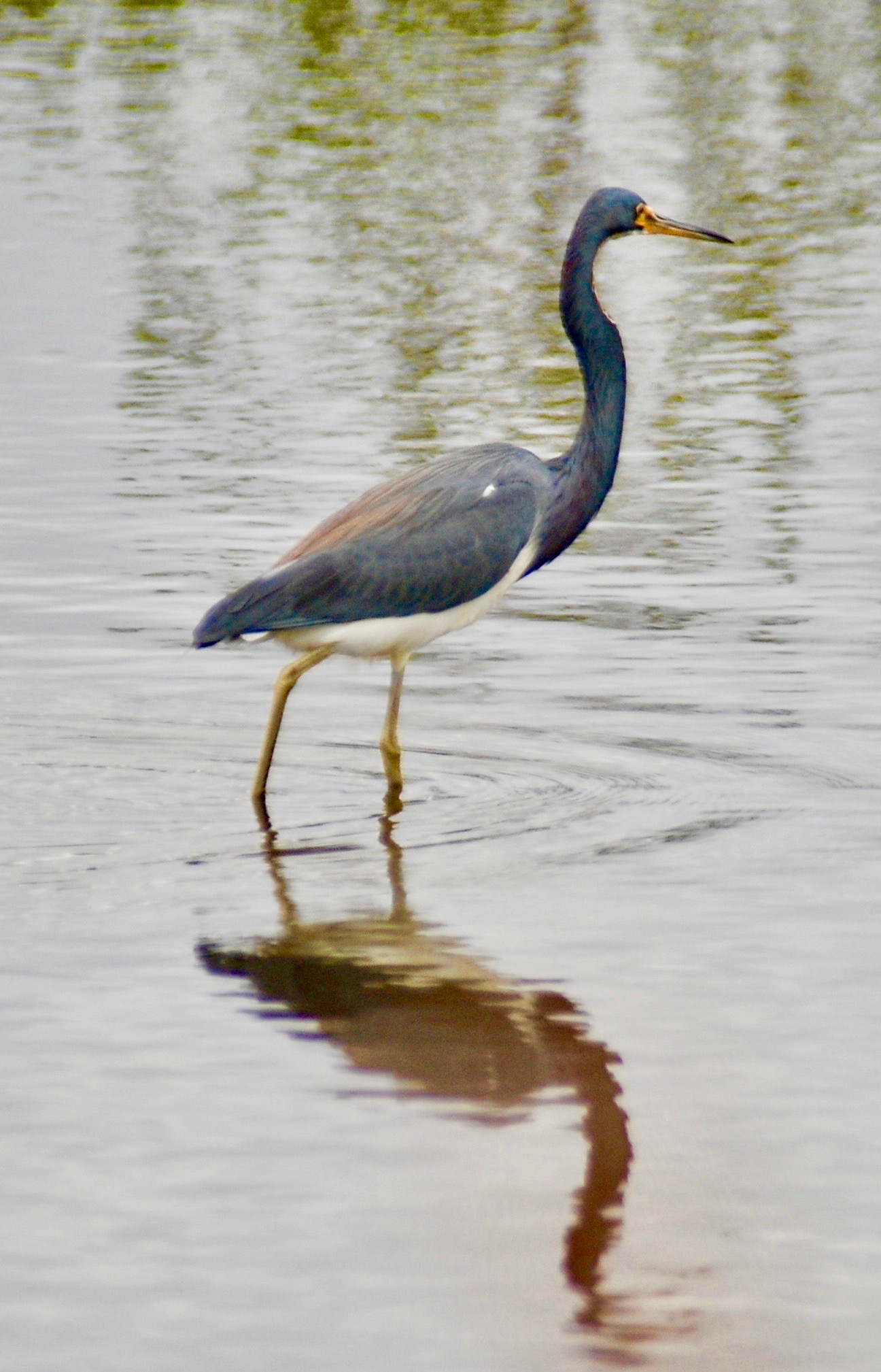
FLORIDA WILDLIFE: Yellow-Crowned Night Heron, Common Moorhen, Sandpiper, American Alligator, Cormorant, Scrub Jay (© Ben Klinger | Dreamstime.com), Florida Key Deer (© Steve Byland | Dreamstime.com)
Their expeditions were inspired by a black bear, M34, trapped by Guthrie and fellow University of Kentucky researcher Wade Ulrey in October 2009. Guthrie and Ulrey attached a GPS tracking collar to M34 to track his movements. Black bears constantly move in search of food, traversing different habitats as food becomes available—grapes and blackberries, saw palmetto berries, acorns. Roaming is also triggered by the breeding season. So in May 2010, M34 took off and, in the next eight weeks, covered 500 miles, first heading generally north until stopped by busy I-4 and then turning back south. Like the wolf, Pluie, at the Y2Y Corridor, Alice the Moose at the A2A Corridor, and the jaguars along the Paseo Pantera (Path of the Panther, M34 demonstrated that connections, however fragile, still exist.
In 2015, a formal non-profit organization grew out of the initiative, also calling itself the “Florida Wildlife Corridor,” with co-founder Mallory Dimmitt serving as the organization’s first executive director, a position she held beginning in 2013 under the initiative. Dimmitt now serves as President of the Board of Directors for the Florida Wildlife Corridor organization, while Jason Lauritsen, with 20 years of experience in conservation and resource management, has taken over as Executive Director. The organization works to ensure “the public and partner support needed to permanently connect, protect and restore the Florida Wildlife Corridor,” with a goal of protecting 300,000 acres within the corridor by the end of 2020.
In the Florida panhandle, a private nature preserve provides a vital link. In 2000, entrepreneur and conservationist M.C. Davis, with wife Stella, bought 53,000 acres to establish Nokuse Plantation; pronounced “no-go-see,” the name is the Native American Creek word for black bear. The Davises’ vision was to connect pockets of the longleaf pine ecosystem on the east with the forests of Eglin Air Force Base on the west. Long undisturbed, Eglin AFB contains old-growth longleaf pine with some trees 500 years old.
The longleaf pine ecosystem once spanned 90 million acres in the coastal regions from Virginia to Texas and as far south in Florida as Lake Okeechobee. Wiregrass, a highly flammable native ground cover, is essential to the ecosystem, taking out the brush and shrub understory when lightning strikes and sets the grass on fire.
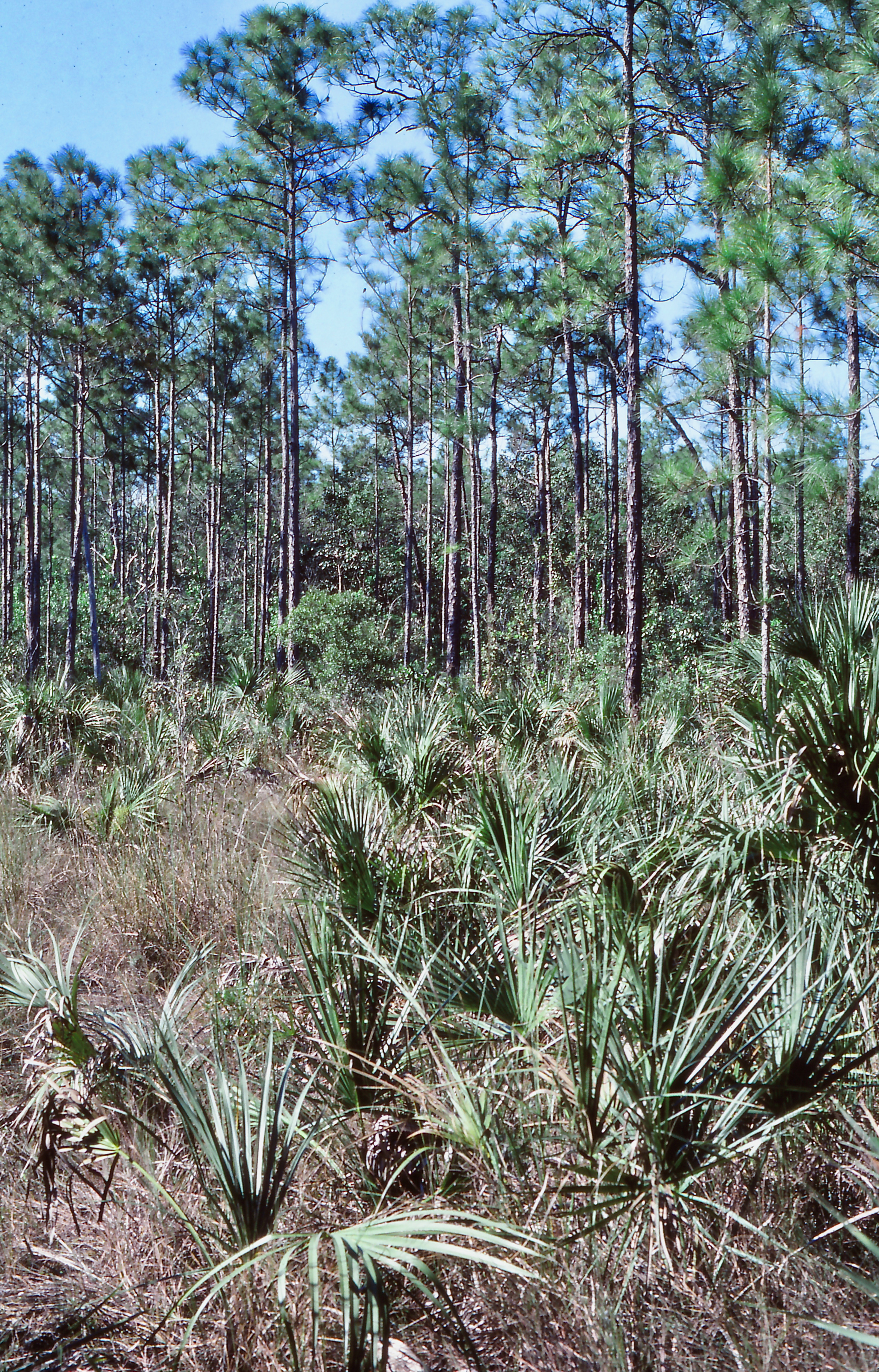
Because of the quality of the wood, longleaf pine fueled the economy of the southern states, and the forests were logged over the last couple of centuries. Only 3% remains, much of that in the 460,000 acres of Eglin AFB, Blackwater River State Forest to the north of Eglin, and Conecuh National Forest in Alabama. The goal of Nokuse is to provide a link to the east as part of the northwest portion of the Florida Wildlife Corridor that will one day connect with 630,000-acre Apalachicola National Forest where longleaf pine and wiregrass forests are being restored.
In a rewilding of Nokuse plantation, the Davises planted eight million pine trees. Then to make the connection to Eglin’s forests, they worked with the Florida Department of Transportation to install an underpass in north-south US 331 to allow animals free passage between the two forests. Fences line the highway to funnel migrating bear, deer, and smaller mammals to the underpass beneath the four-lane highway. Rather than a dark tunnel, the underpass is open in the median separating the northbound and southbound lanes.
The Coastal Headwater Forest–Longleaf Conservation and Restoration project complements this effort to reestablish the longleaf pine ecosystem. Part of America’s Longleaf Pine Restoration Initiative working throughout the historic range of longleaf pine, the Coastal Headwaters Forest project, lead by The Conservation Fund working with Resource Management Service, LLC, is an effort to re-establish a 205,000-acre working longleaf pine forest in the lower Alabama/Florida panhandle region.
Janisse Ray, in her autobiographical Ecology of a Cracker Childhood, tells of growing up in the coastal plains of southern Georgia where remnant longleaf pine haunt the land:
I have a dream for my homeland. I dream we can bring back the longleaf pine forests, along with the sandhills and the savannas, starting now, and that we can bring back all the herbs and trees and wild animals, the ones not irretrievably lost, which deserve an existence apart from slavery to our own.

While bisected by roads and encroached on by development, the land is still there, scattered across Florida. Perhaps half protected in federal and state lands and another good portion conserved by farmers, ranchers, and plantation owners who value their way of life and the natural balance that exists on their lands. With future construction of under- and overpasses so wildlife can cross highways and interstates, and with new acquisition and conservation easements on parcels that are missing links in the corridor, maybe we can bring back the longleaf pine forests and sandhills and savannahs, and a Florida Wildlife Corridor can be assured.
© Russ Manning. All Rights Reserved.
An ebook of much longer text and complete references for Okefenokee to Okeechobee can be downloaded from amazon.com

