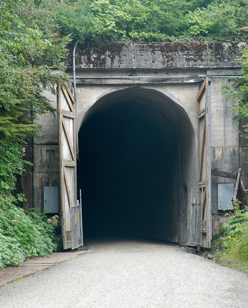
East from Seattle on I-90, the interstate initially traverses the Cascade Range, and I’m hoping to see progress on the I-90 Snoqualmie Pass East Project. While Spokane and Coeur d’Alene on the other side of the Cascades are a straight shot east from Seattle, I-90 first dips southeast to take advantage of the 3,015-foot Snoqualmie Pass through the Cascades. The indigenous people of the northwest used the pass, including the Snoqualmie who occupied this southern Salish Sea region, as did early explorers and settlers who eventually built roads. The first vehicle crossed Snoqualmie Pass in 1905. The Pacific Extension of the Chicago, Milwaukee, St. Paul and Pacific Railroad tunneled through the pass 1912 – 1914, leaving behind the two and a quarter-mile Snoqualmie Tunnel.
Over the decades, that first muddy route through the pass evolved into present-day Interstate 90, the essential east-west route through the Cascades in Washington State. As I approach Snoqualmie Pass from the west, massive sweeps of mountain reach for the sky and deep valleys lie between, clad in evergreen forests “dark and deep” with scattered alpine meadows.
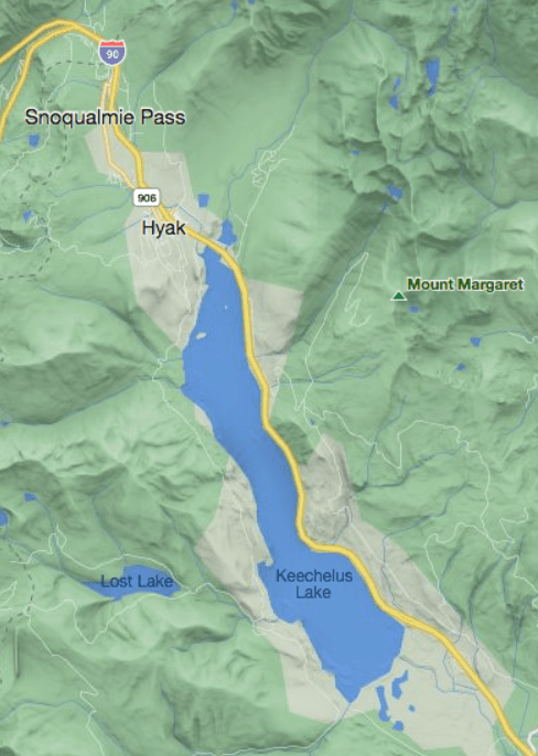
The I-90 Snoqualmie Pass East Project involves just a 15-mile stretch of the interstate on the east side of the pass—from the community of Hyak southeast to Easton. Along that interstate segment, Cascade peaks stand above the interstate on the northeast side, from which snow avalanches occasionally engulf the road in winter. Keechelus Lake at the head of the Yakima River lies immediately on the southwest. Across the lake from the interstate, Cascade peaks once again rise into the sky.
I-90 effectively divides the North Cascades from the Southern Cascades, the latter extending south to the Columbia River Gorge. But I-90 is not just a geographic line bisecting the Cascade Range. The interstate also separates the north-south migration of wildlife, a formidable barrier for ungulates and their predators—mule deer, elk, wolverine, lynx, gray wolf, mountain lion, black bear, as well as smaller animals and a myriad of birds, reptiles, and even fish that inhabit creeks which must make their way under the interstate. Many species inhabiting the Southern Cascades are essentially trapped, with I-90 on the north and the Columbia River Gorge on the south, preventing gene flow with other populations in the range.
So in the 1990s when the Washington State Department of Transportation began to look at upgrading this section of interstate, other agencies and non-government organizations took notice and began to advocate for also accommodating wildlife passage. While not opposed to wildlife considerations, WSDOT officials’ first response was that they knew how to build roads but didn’t know about wildlife, which led to a truly amazing collaboration of interested parties to plan for the I-90 Snoqualmie Pass East Project. The willing cooperation of these groups with sometimes opposing interests has since become a model for similar projects throughout the country to provide for wildlife passage and traffic safety. The Washington State Department of Fish and Wildlife joined the effort, as did the U.S. Forest Service and the U.S. Fish and Wildlife Service. Over time, nearly forty additional organizations became involved, including Conservation Northwest who has led conservation efforts in the area for decades.
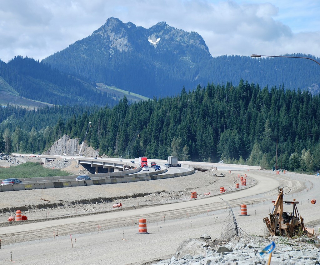
During Phase 1 of the I-90 Snoqualmie Pass East Project, blasting shuts the highway for an hour or two in the mornings. Earth-moving machines precariously perch on rock faces. I turn down National Forest Development (NFD) Road 4832, wanting to get a glimpse of the underpasses that are now nearly complete. Where the road crosses Gold Creek, I have a good view of the construction crew working on the bridge that provides an underpass for the stream.
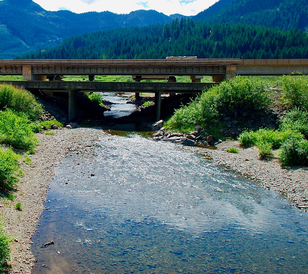
The old bridge is still there, lower and in front of the new bridge, but will be removed. The new bridge is wide enough to allow land mammals to pass on either side. With completion of the underpass, Conservation Northwest, working with the U.S. Forest Service, has led the effort to plant native vegetation and remove non-native flora for the new I-90 wildlife crossings. Volunteers with the organization have worked to create a native habitat that will encourage wildlife to use the Gold Creek underpass.
In 2019, the Washington State Department of Transportation completed Phases 1 and 2 of the I-90 Snoqualmie Pass East Project, which involved seven miles of interstate improvements from Hyak past Keechelus Dam to the Stampede Pass interchange. The underpass at Gold Creek and the first wildlife overpass were included. Wildlife using these crossings have been documented, some using the overpass soon after its completion.
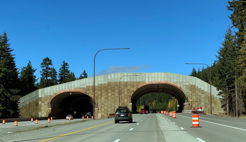
The remaining eight miles of the project from Stampede Pass interchange to the community of Easton will be constructed in two phases and include additional wildlife crossings. The entire project will come to a conclusion in 2031, improving travel ease and safety while also allowing wildlife migration north-south in the Cascades portion of the Pacific Wildway.
The Cascades are in fact an arc of thousands of volcanoes ending in Lassen Peak in California on the south. Some of the youngest mountains in North America, they are part of the “Ring of Fire” encircling the Pacific Ocean basin. The tectonic plates that make up the ocean floor slowly expand as lava extrudes, pushing the ocean plates toward and under the continental plates, a process called “subduction.” The subducted rock partially melts. This magma accumulates until the increasing pressure forces the magma upward to erupt at the surface, and over time build a mountain. In addition to 75% of the earth’s volcanoes (active, dormant, and extinct), 90% of the world’s earthquakes occur along the path of the Ring of Fire.
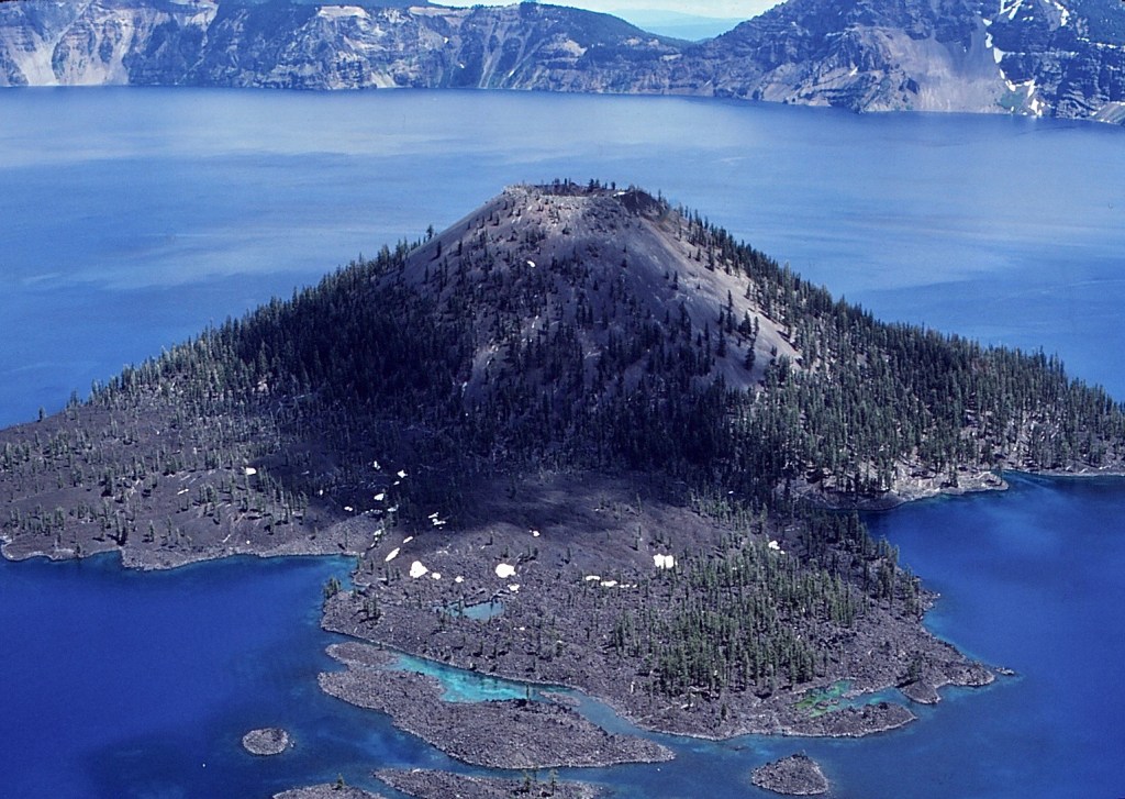
In the Cascades, the eruption of Mount Mazama was one of the biggest. After the mountain blew its top, the remaining caldera more than a half mile deep gradually filled with water to create a circular lake now preserved in Crater Lake National Park. A secondary volcanic cone rose above the waters to leave Wizard Island in the lake.
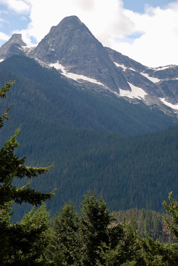
Somewhat incongruously, the Cascade Range is also a land of ice, the most glaciated mountains in continental U.S. The dichotomy is apparent in the title of Stephen Harris’s long-time guide to the Cascades, Fire & Ice. However, climate change has impacted the Cascades as elsewhere. The glaciers are in retreat and over time many will disappear. Glaciologist Mauri Pelto conducts the North Cascades Glacier Climate Project by trekking on foot into the mountains to monitor the glaciers. In 1980, the North Cascades harbored 780 glaciers, but now estimates are around 600. By defining the problem, Pelto hopes something will result to control climate change in time to save a few glaciers.
In June 1981, I would never have a better opportunity to see an active volcano. So after reading everything I could on the Mount St. Helens 1980 eruptions, I arrived in Portland, Oregon and in a rented car headed north toward the still smoldering volcano. At the U.S. Forest Service offices in Vancouver, Washington, the foresters recommended I fly over the mountain. “That’s the best way to see the lay of the land.” So I continued north, looking for a small-craft airport not too far from the volcano. However, the Pacific Northwest climate was uncooperative. The mountain remained shrouded in clouds for a couple of days while I stood around with a lot of curious tourists, waiting for the sky to clear.
With only a couple of daylight hours left, I had given up on seeing the mountain this day. But as I nonchalantly glanced around I caught a glimpse through the trees of a mountain far off to the southeast. It took a few seconds for me to realize I had had my first view of the volcano crater gaping above the clouds that swaddled the mountain’s base. I had passed a small airport not too far back and so wheeled my car around, thinking I could get to the airport and be over the volcano at sunset—perfect timing.
A big sign perched on the roof of the airport office read “Rocky’s Volcano Flights.” Inside, a wall covered with a collage of photos depicted the explosion. “The plume of steam and ash was so huge,” Rocky said, “I had to take multiple photos to cover the whole scene and assemble them into one huge picture.”
I closely examined the patchwork with its voluminous ash cloud. Expecting to see a large volcano spewing an ash cloud, I asked, “But where’s the mountain?”
Rocky pointed to one of the photos near the bottom at what appeared to be just a bump on the horizon. My mouth dropped open as I stood there astonished at the enormous eruption shooting into the sky and dwarfing the mountain itself.
Normally, the volcano flights took four or five people. So while we dickered over the price of a flight just for me, and Rocky talked about the day the volcano blew, I kept glancing at the setting sun. Soon we were on amicable terms, and Rocky agreed to take me up in a two-seater training plane. I could take pictures from the pilot’s seat, which had the only window that would open.
With Rocky handling the controls from the learner’s seat, I could feel the wind lift the small plane as we left the end of the runway. For about 20 minutes, Rocky flew straight for Mount St. Helens.
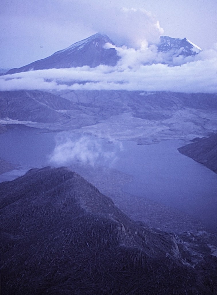
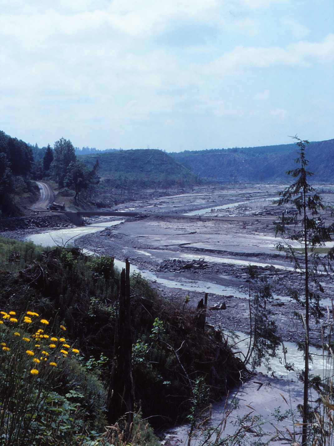
In the blast zone, the land was a uniform gray, covered in ash. Trees were scattered over the hills below us like piles of matchsticks. The North Fork of the Toutle River looked like a broad gully from the air. Melted snow and ice from the volcano’s glaciers had washed into the Toutle, gouging out a larger riverbed and, in the process, sweeping everything along in its path.
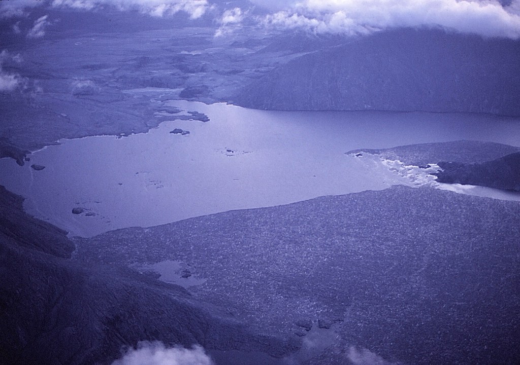
As we neared the mountain, Spirit Lake came into view on the north side of the volcano. Floating logs now covered most of the lake’s surface so thick it seemed I could have walked to the middle of the lake without getting my feet wet.
Having been dormant for 123 years, Mount St. Helens began to show activity in March 1980. The mountain had a history of volcanic activity, which was recognized in the Klickitat name for the mountain, Tah-one-lat-clah, meaning “Fire Mountain.” In the initial activity, earthquakes followed by explosions opened a crater at the summit. Ash and steam rose in a cloud 6,000 feet above the volcano. The bursts continued into April, with craters opening and merging. Thousands of earthquakes were occurring in a “harmonic tremor” that indicated magma and associated gases were moving in the mountain.
Into May, there was visible swelling and cracking of the mountain, with a huge bulge appearing on the north face. Then on May 18th, a 5.1 magnitude earthquake seemed to trigger the collapse of the north side of the mountain, which effectively opened a hole in the pressure cooker containing high-temperature steam and dissolved gases released from the magma. An enormous lateral blast of rock, ash, and hot gases raced 300 miles per hour northward, destroying an area of 230 square miles north of the volcano. An eruption plume rose more than 15 miles into the sky where the winds grabbed the cloud and carried it east across the Northwest states, spreading an estimated 520 million tons of ash.
Since the stratovolcano split open on its northern side instead of at its top, the shock wave moved along the ground, destroying anything and anyone caught in its path. The eruption leveled 150 square miles of forest. While most people had evacuated, fifty-seven died. In 1982, Congress set aside 110,000 acres that includes the volcano as the Mount St. Helens National Volcanic Monument. Since then, the Pacific Northwest Seismic Network monitors seismic activity in the two-state region of the Cascades to better predict future volcanic activity.
“How far do you want to go in?” Rocky yelled over the noise of the plane.
“Just as close as you can get,” I hollered back.
“Well, I’m supposed to stay three miles away, but …”
“Well, okay?!”
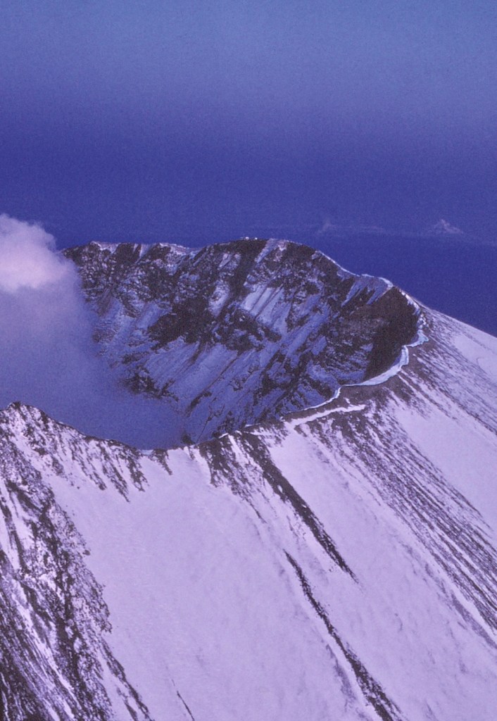
Flying in we passed right along the lip of the crater, and the little plane bucked as Rocky jogged it up over the billowing steam rising from the crater’s mouth and blowing in our direction. By now I was leaning out the window with my camera. The air filled with the smell of sulfur, and I could see streaks of the yellow mineral along the vents in the new lava dome that was forming inside the crater.
“There’s a helicopter,” Rocky said. “Probably the scientists coming up from the crater.”
I looked down, expecting to easily see the aircraft, but saw nothing at first. Then a dark speck appeared and once again I was astounded at the scale of things.
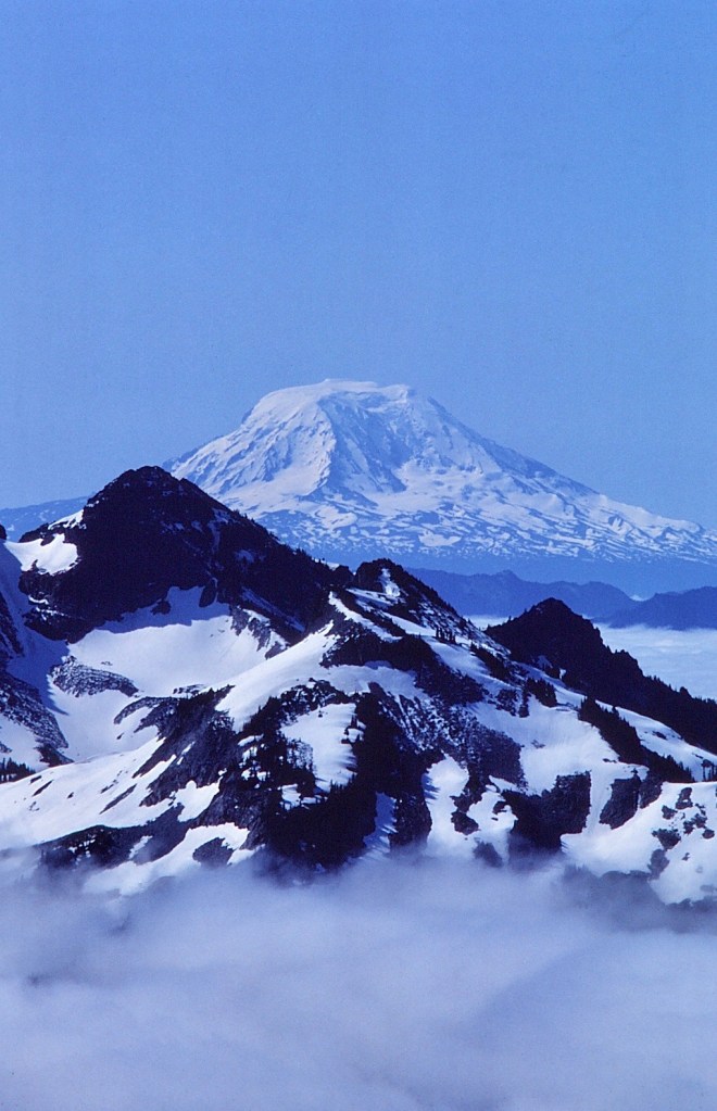
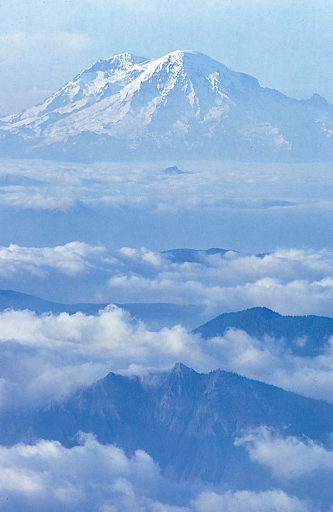
As we lifted away from the volcano, I noticed another mountain in the distance beyond the crater’s lip to the east. Mt. Adams stands at 12,286 feet, the second highest mountain in the Pacific Northwest, topped only by Mt. Rainier at 14,410 feet.
The devastated plain extending north from the one-sided Mount St. Helens’ crater was truly horrible. But this was nature at work, nature going about its business of destruction and rebuilding. While volcanoes are usually seen as destructive, long-term they build earth. Erupting volcanoes bring up nutrients from deep in the earth and spread them in rocks and ash across the surrounding landscape. With breakdown from wind, water, and microbes, rich soils remain that support life.
Following the major eruptions, the mountain continued to send plumes of steam high into the air in non-explosive bursts that pushed the new dome ever higher, gradually rebuilding the mountain. A second dome appeared in 2006 as the mountain re-pressurized with magma. Low-magnitude earthquakes continue. While this indicates the volcano is still active, no eruption is expected “anytime soon.”
Farther north from the Snoqualmie Pass Project, I head into North Cascades National Park on the North Cascades Highway following the Skagit River. At Newhalem, a utility company town, I set up in Newhalem Creek Campground. Seattle City Light operates the town and hydroelectric projects at Ross, Diablo, and Gorge Lakes on the Skagit River. These Skagit River and Newhalem Creek Hydroelectric Projects were added to the National Register of Historic Places in 1996.
To separate this type of land use from national park lands, this strip of the North Cascades along the highway and river has been designated Ross Lake National Recreation Area, with the north and south units of the national park to either side. Together, the recreation area and park units are managed as the North Cascades National Park Complex, along with Lake Chelan National Recreation Area on the southeast. Within this complex, the 638,000-acre Stephen Mather Wilderness, named for the first NPS Director, is at the center of two million acres of wild lands containing five other wilderness areas: Pasayten to the northeast, Mount Baker to the northwest, Noisy-Diobsud to the west, Glacier Peak to the southwest, and Lake Chelan-Sawtooth to the southeast.
While wilderness acreage the size of Yellowstone National Park provides a degree of connectivity, I’m curious whether the North Cascades Highway, also designated State Highway 20, poses an obstacle for wildlife movement north-south. The North Cascades Ecosystem supports a nearly full complement of apex predators—black bears, gray wolves, wolverines, coyote, mountain lion, lynx—indicating a healthy ecosystem. However, continued existence of these populations is dependent not only on preservation of this region but also movement within the system to maintain genetic diversity. Roads tend to break an ecosystem into parts and isolate populations, leading to inbreeding and population declines.
Field work for the report, The Cascades Carnivore Connectivity Project: A Landscape Genetic Assessment of Connectivity for Carnivores in Washington’s North Cascades Ecosystem, occurred in 2008-2011. The study did not just look at Highway 20 through the Park Complex, but also I-90 at the southern end of the North Cascades and U.S. Route 2 that also crosses the Cascades between the other two routes, all traveling east to west and so intersecting wildlife movement north-south. Through gene identification, 561 individual black bears were noted.
The results were unexpected. Two distinct genetic populations were identified, but not north and south of any of the three highways, but rather an area north of Route 2 where there seemed to be a reduction in gene flow. “While this shift could reflect simple isolation by distance,” the report authors state, “the rate of the change in probable group assignment from south to north suggests a resistance to gene flow beyond a typical isolation-by-distance effect.” Further they note,
This region of reduced gene flow does not appear to reflect any obvious anthropogenic landscape feature (e.g., highway, urban land cover), nor does it correspond to a marked change in land cover or natural community type. It does coincide, however, with an area where the Cascades Range increases dramatically in elevation and ruggedness, and where Glacier Peak and its surrounding ridges and passes are dominant features.
In one explanation, the researchers note that black bears, typically dispersing in early to mid-summer, likely avoid high-elevation, snow-covered ridges in favor of low elevations, especially where hiking trails make passage easier.
… the importance of lower elevation connectivity among forested habitat patches is heightened. The loss of such connections as a result of habitat conversion, climate change, or human development could have ramifications for movement and gene flow for bears.
Grizzly bears are conspicuously absent in the Cascades, especially in the U.S. portion. However, grizzlies have always been part of the North Cascades Ecosystem (NCE), 97% of which is federal, state, and local public land. In the 1800s, trappers, miners, and bounty hunters nearly wiped out the population, so that today grizzlies are rarely seen. The National Park Service states, “No one knows how many grizzly bears remain in the ecosystem, except that there are very few.” The most optimistic guess for the U.S. portion of the North Cascades is ten bears, but only a couple have been spotted in the last decades.

The organization, Friends of the North Cascades Grizzly Bear, continues its commitment to recovery of the grizzly population. As noted elsewhere, the presence of apex predators contributes to the health of an ecosystem, so the overall objective in grizzly restoration is ecosystem revitalization. As Dave Foreman says in Rewilding North America, “Restoring large carnivores begins to heal ecosystems. It’s that simple.”
In the meantime, the U.S. Fish & Wildlife Service identifies the North Cascades as one of six recovery zones for the grizzly bear. “Each recovery zone represents an area large enough and of sufficient habitat quality to support a recovered grizzly bear population.” While, grizzlies are considered recovered by the Interagency Grizzly Bear Committee in the Greater Yellowstone and Northern Continental Divide Ecosystems, Fish & Wildlife says, “There are currently no known populations within the North Cascades …” Recognizing the need for connectivity, the Service states “that movement between recovery areas would be necessary for isolated populations to increase and sustain themselves at recovery levels.”
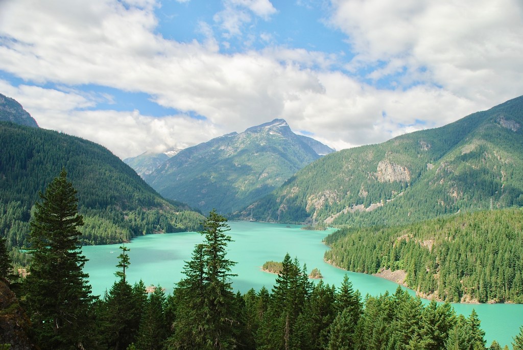
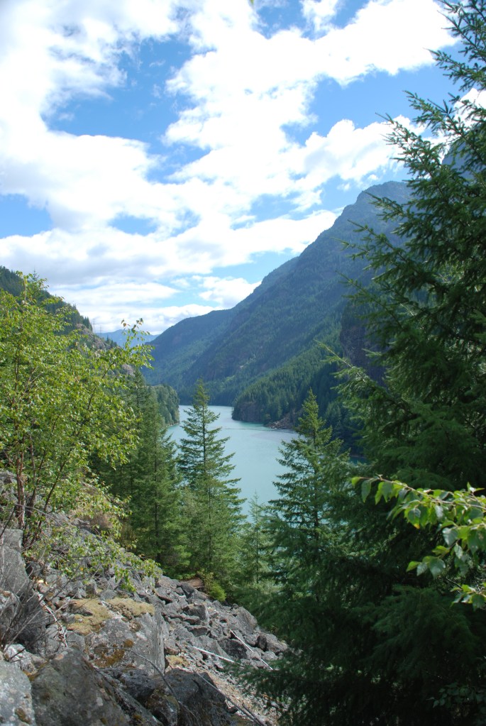
Before leaving the recreation area, the North Cascades Highway skirts Diablo Lake and then Ross Lake that stretches north to the Canadian border. There in June 1956, in what would become the national park, Jack Kerouac made his way up Desolation Peak where he would spend the summer as a fire lookout for the Forest Service. At the time, this was Mount Baker National Forest. Kerouac was following the example of Gary Snyder, his fellow Beat poet, who had served as a lookout on Crater Mountain in 1952 and Sourdough Mountain in 1953 and who had recommended the isolation in nature as a Zen experience.
The old lookout cabin is still there. Throughout the country, such lookouts are no longer used in favor of natural fire ecology; fires that start naturally are usually allowed to burn unless they threaten people and buildings. Also, intentional fire is used to remove understory and detritus on the forest floor, which prevents the buildup that may fuel a future fire too hot for the forest to survive.
Snyder later won the Pulitzer Prize for a collection of his poetry in Turtle Island. Here’s his “Mid-August at Sourdough Mountain Lookout” from Riprap and Cold Mountain Poems:
Down valley a smoke haze
Three days heat, after five days rain
Pitch glows on the fir-cones
Across rocks and meadows
Swarms of new flies.
I cannot remember things I once read
A few friends, but they are in cities.
Drinking cold snow-water from a tin cup
Looking down for miles
Through high still air.
In The Dharma Bums, in which Kerouac recounts his group’s search for Buddhist enlightenment, he tells of his first morning atop Desolation:
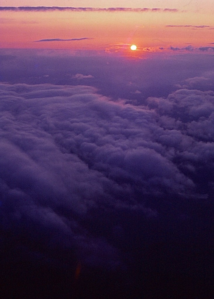
I went out in my alpine yard and there it was, everything Japhy (as he called Snyder in the novel) said it was, hundreds of miles of pure snow-covered rocks and virgin lakes and high timber, and below, instead of the world, I saw a sea of marshmallow clouds flat as a roof and extending miles and miles in every direction …”
Philip Whalen, another poet, served as lookout on Sauk Mountain the same summer Snyder was on Sourdough Mountain and later on Sourdough himself. Whalen writes in his poem “Sourdough Mountain Lookout,” from Overtime, Selected Poems:
Then I’m alone in a glass house on a ridge
Encircled by chiming mountains
With one sun roaring through the house all day
& the others crashing through the glass all night
© Russ Manning. All Rights Reserved.
An ebook of much longer text and complete references for The Cascades: Snoqualmie Pass can be downloaded at amazon.com.
This second edition updates the efforts to reintroduce grizzlies to the North Cascades and provides the history of the national park designation, the spotted owl controversy, and the fight over mining in the Glacier Peak Wilderness during the first years following the Wilderness Act of 1964.
